Chatanga (place)
| Village
Khatanga
атанга
|
||||||||||||||||||||||||||
|
||||||||||||||||||||||||||
|
||||||||||||||||||||||||||
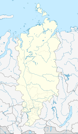
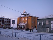
Khatanga ( Russian Хатанга ) is a village in the Russian region of Krasnoyarsk (until its dissolution at the end of 2006 in the Taimyr Autonomous Okrug , now Taimyr Rajon of the Dolgans and Nenets) in northern Siberia . It has 2645 inhabitants (as of October 14, 2010) and is the seat of the rural community Chatangskoje selskoje posselenije.
Geographical location
Chatanga lies in the Taimyrsenke , the central part of the North Siberian lowland about 15 km downstream of the confluence of Cheta and Kotui to Chatanga and about 208 km above the estuary khatanga gulf that in the Arctic Ocean belonging Laptev over passes. In a region of the tundra rich in lakes and swamps , it is located directly on the Chatanga at 1 m above sea level.
various
Chatanga has the Chatanga airport ( ICAO code : UOHH), a hotel, a natural history museum and several weather stations. It is the starting point for many polar expeditions.
history
The settlement was founded as Khatanskoye (Хатанское).
During the Second World War , exiled slave laborers in and around Chatanga were mainly engaged in catching and processing fish. The exiles were mostly Volga Germans , Finns and Latvians .
On December 6, 1969, there was a plane crash 13 km from Chatanga Airport, with 8 fatalities caused by the heavy icing of the wings.
The place was also known for the Jarkow mammoth , which was recovered from the permafrost soil of the Taimyr Peninsula in 1999 and then stored and examined in the Khatanga ice cave, which was built in the 1950s as an interim store for fish and meat. Several partially preserved mammoths and other rare fossils had previously been discovered in the Chatanga region.
Population development
| year | Residents |
|---|---|
| 1939 | 1037 |
| 1959 | 1979 |
| 1970 | 3833 |
| 1979 | 4868 |
| 1989 | 6385 |
| 2002 | 3450 |
| 2010 | 2645 |
Note: census data
climate

The climate in Chatanga is subpolar-continental with humid characteristics. The annual average temperature is −13.8 ° C. The warmest month is July with about +12 ° C. At this time of year, the thermometer often rises to over +25 ° C; the highest measured temperature was +36.7 ° C. The coldest month, January, has an average temperature of −35 ° C; the lowest measured temperature was −59 ° C. The annual rainfall averages 296 mm. The main amount of precipitation falls in the months of June to October. The Chatanga region is often hit by hurricanes .
swell
- ↑ a b Itogi Vserossijskoj perepisi naselenija 2010 goda. Tom 1. Čislennostʹ i razmeščenie naselenija (Results of the All-Russian Census 2010. Volume 1. Number and distribution of the population). Tables 5 , pp. 12-209; 11 , pp. 312–979 (download from the website of the Federal Service for State Statistics of the Russian Federation)
- ↑ Chatanga . In: Meyers Konversations-Lexikon . 4th edition. Volume 3, Verlag des Bibliographisches Institut, Leipzig / Vienna 1885–1892, p. 963.
- ↑ Exile / camp detention report by Ella Davidowna Korolska
- ^ Report on plane crash - Aviation Safety
- ^ Spiegel Online
- ↑ Geoclimate 2.1
- ↑ Weather in Khatanga , on pogodaiklimat.ru (Russian)


