Cheta
| Cheta | ||
|
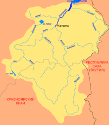
The Cheta as the left, northern source river of the Chatanga |
||
| Data | ||
| location | Krasnoyarsk region in northern Russia | |
| River system | Chatanga | |
| Drain over | Chatanga → Chatanga golf | |
| source | Confluence of the Ajan and Ajakli rivers in the Putorana Mountains 70 ° 10 ′ 14 ″ N , 95 ° 47 ′ 0 ″ E |
|
| muzzle | near Kresty , union with Kotui to Chatanga Coordinates: 71 ° 54 ′ 56 ″ N , 102 ° 6 ′ 10 ″ E 71 ° 54 ′ 56 ″ N , 102 ° 6 ′ 10 ″ E
|
|
| length | 604 km | |
| Catchment area | 100,000 km² | |
| Drain |
MQ |
1370 m³ / s |
| Left tributaries |
Ayan (spring river), Volochanka , Boganida |
|
| Right tributaries |
Ajakli (spring river), Bojarka , Maimetscha |
|
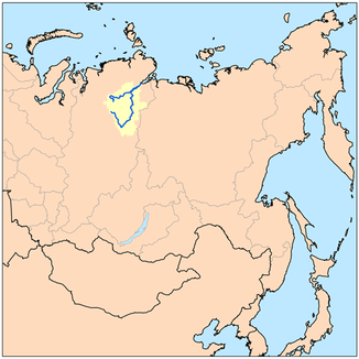
The Cheta ( Russian Хета ) is 604 km long, left-side and southwestern source river of Khatanga in northern Siberia ( Russia , Asia ) and runs in the former Autonomous District Taimyr in the north of the Krasnoyarsk region .
course
The Cheta arises a little north of the Arctic Circle in the practically uninhabited Putorana Mountains , the northwest part of the Central Siberian Mountains , through the confluence of the Ajan and Ajakli . She leaves the mountains to the north and then flows in the south of the Taimyr peninsula located Taimyrsenke first west and then mainly to the northeast. Finally, at the settlement of Kresty , about 15 km southwest of the village of Chatanga , it unites with the Kotui to form Chatanga. The latter flows further northeast into the Laptev Sea , a marginal sea of the Arctic Ocean .
Ice drift and navigability
The river is frozen from late September / early October to late May / early June. In the ice-free time it is suitable for navigation.
Individual evidence
- ↑ a b c Article Cheta in the Great Soviet Encyclopedia (BSE) , 3rd edition 1969–1978 (Russian)

