Cheviot (New Zealand)
| cheviot | ||
| Geographical location | ||
|
|
||
| Coordinates | 42 ° 49 ′ S , 173 ° 16 ′ E | |
| Region ISO | NZ-CAN | |
| Country |
|
|
| region | Canterbury | |
| District | Hurunui District | |
| Ward | Cheviot Ward | |
| Residents | 369 (2013) | |
| height | 66 m | |
| Post Code | 7310 | |
| Telephone code | +64 (0) 3 | |
| UN / LOCODE | NZ CHE | |
| Photography of the place | ||
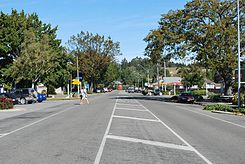
 New Zealand State Highway 1 in Cheviot |
||

Cheviot is a small town in the Hurunui District in the Canterbury regionon the South Island of New Zealand .
Origin of name
The village was named after the surrounding Cheviot Hills , the name of which is derived from the group of hills of the same name between England and Scotland .
geography
The place is about 60 km north of the district capital Amberley and about 90 km south of Kaikoura on the east coast of the Pacific Ocean .
To the south-east is the surfing beach of Gore Bay and the historic port area of Port Robinson , which was used for freight transport in the 19th century by William Robinson , a businessman and landowner in Cheviot at the time. However, the area around the natural harbor , which was closed in 1908, is difficult to access and due to the erosion only the former quay can be seen.
To the north you first meet the St. Anne's Lagoon and further in this direction to the settlement Parnassus , where a bridge has been crossing the Waiau River since the 1930s . The old construction has since been replaced by a new one.
population
In the 2013 census, the town had 369 inhabitants, 5.4% less than in the 2006 census.
Infrastructure
Road traffic
The New Zealand State Highway 1 runs through Cheviot and connects the town to Christchurch in the south and Kaikoura in the north .
Rail transport
The Main North Line railway passes close by. A stopping point where the TranzCoastal train stops on its journey from Picton to Christchurch is to the west of the suburban settlement of Mina .
Another stop was originally a little further south near the Hurunui River near the small railway town of Domett , which was named after Alfred Domett , the fourth Prime Minister of New Zealand . It started operating in 1907, but was shut down in 1982. The run-down station building was relocated in 1996, restored true to the original and reopened as the Mainline Station Café . The restaurant with attached souvenir shop has all sorts of memorabilia from the history of the railway.
Attractions
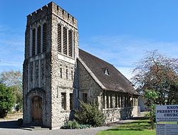
In addition to several churches, you can visit the Cheviot Museum , which shows an exhibition on the history of the settlement.
earthquake
On November 16, 1901, the epicenter of the Cheviot earthquake was in this area, which caused severe damage in the Canterbury region (including the repeated demolition of the steeple of the former ChristChurch Cathedral in Christchurch, about 100 kilometers away ) and one death.
Web links
Individual evidence
- ↑ a b 2013 Census QuickStats about a place: Cheviot . Statistics New Zealand , accessed August 8, 2016 .
- ↑ a b Topo250 maps . Land Information New Zealand , accessed June 21, 2017 .
- ↑ Mina Station . NearbyNZ , accessed February 2, 2016 .
- ↑ NZine - The Main Line Station Restaurant, Domett, North Canterbury
- ↑ Event Finder NZ, Cheviot Museum
- ^ New Zealand Parliament, Major New Zealand Earthquakes
