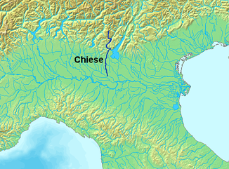
Chiese (river)
| Chiese | ||
| Data | ||
| location | Italy | |
| River system | Po | |
| Drain over | Oglio → Po → Adria | |
| River basin district | Padano | |
| source | at Rauchkopfel 46 ° 8 ′ 38 ″ N , 10 ° 33 ′ 59 ″ E |
|
| Source height | 3418 m slm | |
| muzzle | at Acquanegra sul Chiese in the Oglio coordinates: 45 ° 8 ′ 29 ″ N , 10 ° 25 ′ 16 ″ E 45 ° 8 ′ 29 ″ N , 10 ° 25 ′ 16 ″ E
|
|
| length | 160 km | |
| Catchment area | 960 km² | |
| Drain |
MQ |
36 m³ / s |
| Left tributaries | Adanà, Palvico | |
| Right tributaries | Caffaro , Nozza | |
| Flowing lakes | Lake Idro | |
The Chiese is a river in northern Italy .
course
It rises on Rauchkofel ( Monte Fumo , ADAMELLO , Trentino ), flows through the Val di Fumo , flows into the artificial lake Lago di Malga Bissina , leaves it to the Val di Daone , then leads into the equally artificial lake Lago di Malga Boazzo flows from Pieve di Bono through the Val Giudicarie Inferiore and flows into Lake Idro at Ponte Caffaro . Then it runs through the Val Sabbia until it reaches the Po Valley about 30 km east of Brescia . After 160 km, it finally flows into the Oglio , a tributary of the Po, at Acquanegra sul Chiese .
description
Its catchment area is very watery, and the Chiese and many tributaries are used to generate electricity . The river carries an average of 36 m³ / s of water.
In ancient times the river was called Clusius, Clesus or Cleusis ( Tabula Peutingeriana ).


