Palvico
| Palvico | ||
|
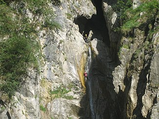
Canyoning in the Palvico, here Buco della morte (it .: about hole of death ) |
||
| Data | ||
| location | Trentino , Italy | |
| River system | Po | |
| Drain over | Chiese → Oglio → Po → Adriatic Sea | |
| River basin district | Padano | |
| source |
Lago d'Ampola 45 ° 52 ′ 14 " N , 10 ° 39 ′ 4" E |
|
| Source height | 730 m slm | |
| muzzle |
Chiese coordinates: 45 ° 49'8 " N , 10 ° 32'56" E 45 ° 49'8 " N , 10 ° 32'56" E. |
|
| Mouth height | 385 m slm | |
| Height difference | 345 m | |
| Bottom slope | 22 ‰ | |
| length | 16 km | |
| Catchment area | 64.6 km² | |
| Left tributaries | Lorina | |
|
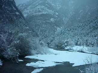
Palvico at Storo |
||
The Palvico ( Italian Torrente Palvico ) is a 16 km long mountain stream in the Lake Garda mountains in southwestern Trentino .
course
It rises as an outflow from Lake Ampola and flows into the Chiese near Storo . On its course, it flows through the Val d'Ampola, in a canyon that is partially deeply incised and the goal of canyoning tours, through several basins with a difference in altitude of up to 20 m. The exit of the last basin is 50 m above the valley floor near Storo. The difference in altitude has been used by several hydropower plants since 1905. Its main tributaries include Casina, Bragone, Lorina, Fontana Bianca and Retorto.
State road 240 Loppio - Val di Ledro runs through the Ampolatal .


