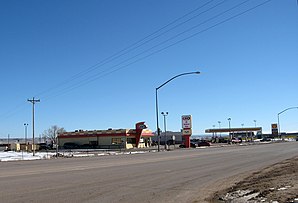
Chinle
| Chinle | |
|---|---|
 |
|
| Location in County and Arizona | |
| Basic data | |
| State : | United States |
| State : | Arizona |
| County : | Apache County |
| Coordinates : | 36 ° 9 ′ N , 109 ° 35 ′ W |
| Time zone : | Mountain Standard Time ( UTC − 7 ) |
| Residents : | 5,698 (as of 2017) |
| Population density : | 137.6 inhabitants per km 2 |
| Area : | 41.5 km 2 (approx. 16 mi 2 ) of which 41.4 km 2 (approx. 16 mi 2 ) is land |
| Height : | 1678 m |
| Postal code : | 86503 |
| Area code : | +1 928 |
| FIPS : | 04-12770 |
| GNIS ID : | 0002861 |
Chinle (Navajo: Chʼínílį́) is a census-designated place in Apache County in the US state of Arizona . It lies to the west below the Defiance Plateau , which is a maximum of 2400 m high, at an altitude of 1678 m. The place is in the Navajo Nation Reservation and borders the Canyon de Chelly National Monument , a canyon landscape of particular geological and historical importance. In the 2010 census , Chinle had 4518 inhabitants, an estimate from 2017 is 5698 inhabitants. US Highway 191 runs west of the city .
Demographics
At the 2000 census, 91.28% of the population were indigenous, 6.39% were white, 1.83% were Latinos, 0.19% were black, 0.17% were Asian, 0, 04% to Pacific residents, 1.34% said more than one race.
school
There is Chinle High School in the village.
health
The Chinle Comprehensive Health Care Facility (CCHCF) is an important hospital and health center with a 24-hour emergency ward in Chinle. It is part of the Navajo Area Indian Health Service.
sons and daughters of the town
- RC Gorman (1931-2005), a Navajo artist
- Jeremiah Bitsui , actor
Web links
Individual evidence
- ↑ Chinle CDP, Arizona , factfinder.census.gov, accessed July 6, 2019.
