Col de Marie-Blanque
| Col de Marie-Blanque | |||
|---|---|---|---|
|
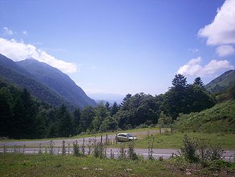
View of the top of the pass |
|||
| Compass direction | west | east | |
| Pass height | 1035 m | ||
| Department | Pyrénées-Atlantiques , France | ||
| Valley locations | Escot | Bielle | |
| expansion | D 294 | ||
| Mountains | Pyrenees | ||
| profile | |||
| Mountain scoring | 1 | 2 | |
| Ø pitch | 7.7% (715 m / 9.3 km) | 5.1% (585 m / 11.5 km) | |
| Max. Incline | 11% | 8.5% | |
| map | |||
|
|
|||
| Coordinates | 43 ° 4 ′ 13 ″ N , 0 ° 30 ′ 27 ″ W | ||
The Col de Marie-Blanque ( 1035 m ) is a mountain pass in the French Pyrenees in the Pyrénées-Atlantiques department . It connects the Vallée d'Aspe with the Vallée d'Ossau .
The closest larger cities are Pau and the pilgrimage city of Lourdes .
From the small village of Escot , the west climb to the top of the pass is 9.3 km long and on average 7.7% steep, the steepest gradient is 13%. From there you can reach the Bénou tray . The top of the pass and the east side of Louvie-Juzon are unspectacular.
The Col de Marie-Blanque has been included in the Tour de France thirteen times since 1978 , including the 10th stage in 2006 and the 16th stage in 2007 . It is usually part of difficult stages in the Pyrenees, the Marie-Blanque is usually followed by the Col d'Aubisque . In 2010 the Col de Marie-Blanque will be skied on the 17th stage as the first category mountain classification.
Here it is considered a mountain with a particular enthusiasm for the public. Cyril Dessel , a winner of the mountain classification at Marie Blanque, raved about its scenery.

