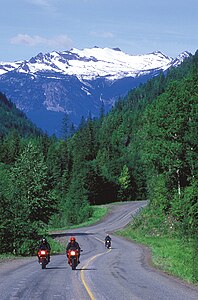
Colville National Forest
|
Colville National Forest
IUCN Category VI - Protected Area with Sustainable use of Natural Resources |
||
| location | Washington , USA | |
| surface | 3862.36 km² | |
| Geographical location | 48 ° 41 ′ N , 117 ° 38 ′ W | |
|
|
||
| Setup date | March 1, 1907 | |
| administration | US Forest Service | |
The Colville National Forest is a national forest in the northeast of the US state Washington . It is bounded to the west by the Okanogan National Forest and to the east by Kaniksu National Forest . In the forest itself are the Little Pend Oreille National Wildlife Refuge and the Lake Roosevelt National Recreation Area . The closest city is Colville .
description
The forest covers a mountainous area with the mountain ranges Kettle River Range and Selkirk Mountains , also the upper reaches of the Columbia River . Wildlife found in the forest include the grizzly bear and American black bear , Mackenzie wolf , bighorn sheep , North American puma , bald eagle , Canadian lynx , elk , Canadian beaver , loons and the last remaining herd of caribou in the Lower 48 of the United States.
The forest has a total area of 4,451.54 km². A study by the Forest Service estimates the primary forest stock at 85,991 hectares. In descending order of the area proportions, the forest is located in parts of the counties Ferry , Pend Oreille and Stevens . The head office is located in Colville . There are Ranger district offices in Kettle Falls , Metaline Falls , Newport, and Republic .
Most of the Salmo-Priest Wilderness lies within the Colville National Forest, but the southeast region extends into the Kaniksu National Forest .
Other protected areas
The Pacific Northwest National Scenic Trail traverses the Colville National Forest. It reaches the forest on the east side in the Salmo-Priest Wilderness , crosses the Little Pend Oreille National Wildlife Refuge at Boundary Dam , crosses Leadpoint and Northport , then crosses the Kettle Range and leaves the forest near Republic . The Sullivan Lake Trail , designated a National Recreation Trail in 1978, runs for 6.9 km between 2 campsites in the forest.
See also
- International Selkirk Loop website (at Wikipedia)
Individual evidence
- ↑ Land Areas of the National Forest System . US Forest Service. January 2012. Retrieved June 30, 2012.
- ^ The National Forests of the United States . ForestHistory.org. Archived from the original on February 12, 2013. Retrieved July 30.
- ^ Charles L. Bolsinger, Karen L. Waddell: Area of old-growth forests in California, Oregon, and Washington . In: United States Forest Service , Pacific Northwest Research Station (Ed.): Resource Bulletin PNW-RB-197 . 1993.
- ^ Sullivan Lake . American trails. April 24, 2013. Retrieved August 14, 2014.

