
Croce di Sasso
| Croce di Sasso | ||
|---|---|---|
| height | 2132 m above sea level M. | |
| location | Canton Ticino , Switzerland | |
| Mountains | Gotthard massif | |
| Dominance | 0.62 km → Pizzo Pianché | |
| Notch height | 30 m ↓ Southeast of Croce di Sasso | |
| Coordinates | 712 799 / 142489 | |
|
||
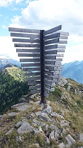
 The stone cross on the Croce di Sasso |
||

The Croce di Sasso ( Italian for stone cross ) is a mountain between Acquarossa and Faido in the canton of Ticino in Switzerland with an altitude of 2132 m above sea level. M. 15 m away from the highest point on the side of the Valle Leventina is located, as the name suggests, a stone cross.
Location and surroundings
The Croce di Sasso is part of the Gotthard massif . It is located between Pizzo Erra and the Matro . The municipal boundary between Faido and Acquarossa runs over the ridge, which stretches from northwest to southeast . The two flanks to the northeast and southwest are gentle and overgrown. The Croce di Sasso is bordered in the northeast by the Valle di Blenio and in the southwest by the Valle Leventina .
The neighboring peaks include the Pizzo Erra and Pizzo Pianché in the north-west and the Pianca Bella , the Cogn and the Matro in the south-east.
Line crossing

The ridge hike from the Passo dei Laghetti ( 2129 m ) to the Matro ( 2172 m ) is a scenic and varied day hike. It offers a great panoramic view of the Valle di Blenio , the Valle Leventina and the surrounding mountains. With a detour to Pizzo Pianché, five peaks are reached. These are from northwest to southeast the Pizzo Pianché ( 2228 m ), the Croce di Sasso ( 2132 m ), the Pianca Bella ( 2165 m ), the Cogn ( 2166 m ) and the Matro ( 2172 m ). The route is partly marked with small, yellow dots. Often there is also a path that partly leads past the bumps next to the edge of the ridge.
The ridge crossing from Passo dei Laghetti to Matro takes about 1½ hours and is indicated with difficulty EB .
Routes to the summit
From the Passo dei Laghetti
From the matro |

Over the southwest flank
- Starting point: Cavagnago ( 1020 m )
- Via: Dèiro ( 1407 m ), Fararenca ( 1548 m ), Alpe Foppascia
- Difficulty: EB
- Time required: 2½ hours
- Remarks: As far as Fararenca on a small road, then on a small path, at the end pathless.
Over the northeast flank
- Starting point: Tizzerascia ( 1277 m )
- Via: On the hiking trail via Brusacu, Garina ( 1634 m ), then at P 1667 take the path south to under the Croce di Sasso, which can then be reached via the northeast slope without any technical difficulties.
- Difficulty: EB
- Time required: 2½ hours
gallery

Croce di Sasso on the left, Pizzo Pianché on the right and Pizzo Erra in the middle in the back .
Avalanche barriers on the ridge between Pizzo Pianché and Croce di Sasso.


literature
- Giuseppe Brenna: Club Guide, Ticino Alps, Volume III (From Piora to Pizzo di Claro). Verlag des SAC, 1996, ISBN 3-85902-163-X , p. 175.
- National map of Switzerland, sheet 1273 Biasca, 1: 25000, Federal Office of Topography, 2014 edition.