
Pizzo Erra
| Pizzo Erra | ||
|---|---|---|
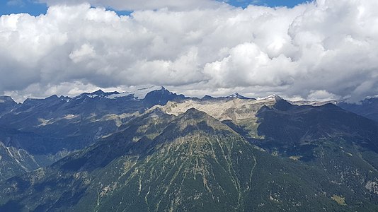
 Pizzo Erra from the southeast |
||
| height | 2417 m above sea level M. | |
| location | Canton Ticino , Switzerland | |
| Mountains | Gotthard massif | |
| Dominance | 5.54 km → Poncione di Nara | |
| Notch height | 301 m ↓ Bassa di Laghetto | |
| Coordinates | 711 781 / 144028 | |
|
||
 Sculpture on the summit of Pizzo Erra |
||

The Pizzo Erra is a mountain between Acquarossa and Faido in the canton of Ticino in Switzerland with a height of 2416.4 m above sea level. M. It was already listed as Piz Erra on the Siegfried map. In the following editions he was also called Culpiana and Pizzo d'Erra . According to the club guide , the summit is a vantage point with a wonderful view of the wide Adula group , the Cima del Simano and the rugged mountains of the Val Verzasca . In addition to its shape, you can recognize the mountain - for example from the Riviera - on its sloping southern flank consisting of rocky ridges and steep gullies.
Location and surroundings
The Pizzo Erra belongs to the Gotthard massif . It forms the highest elevation of the chain southeast of the Bassa di Nara. The municipal boundary between Acquarossa and Faido runs above the summit . The Pizzo Erra is bordered in the northeast by the Valle di Blenio and in the southwest by the Valle Leventina .
The neighboring peaks include the Pizzo Alto in the north-west and the Pizzo Pianché in the south-east. A peak of almost the same height rises a little away from the culmination point, on the northwest ridge.
Routes to the summit
Over the southeast ridge
- Starting point: Cavagnago ( 1020 m ) or Anzonico ( 984 m ) in the Valle Leventina or Tizzerascia ( 1277 m ) in the Valle di Blenio
- Via: Passo dei Laghetti ( 2130 m )
- Difficulty: EB
- Time required: 3¾ hours from Cavagnago and Anzonico or 3¼ hours from Tizzerascia (50 min. From Passo dei Laghetti)
- Comment: From Cavagnago and Anzonico on a good path, from Tizzerascia partly pathless to the Passo dei Laghetti
Over the southwest flank
Over the northwest ridge
- Starting point: Pizzo Caslett ( 2293 m )
- Difficulty: L
- Time required: 50 min.
Over the northeast flank
- Starting point: Tizzerascia ( 1277 m )
- Via: Alpe Tarch
- Difficulty: EB
- Time required: 2½ hours
panorama

gallery
View to the northeast to the Rheinwaldhorn .

View down into the Valle di Blenio .

Pizzo Erra (back), taken from the Cogn .

Small lake at Passo dei Laghetti.


literature
- Giuseppe Brenna: Club Guide, Ticino Alps, Volume III (From Piora to Pizzo di Claro). Verlag des SAC, 1996, ISBN 3-85902-163-X , pp. 171-174.
- National map of Switzerland, sheet 1273 Biasca , 1: 25,000, Federal Office of Topography, 2014 edition.
Web links
Individual evidence
- ↑ Giuseppe Brenna: Club Guide, Ticino Alps, Volume III (From Piora to Pizzo di Claro). Verlag des SAC, 1996, ISBN 3-85902-163-X , p. 172.