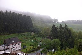
Dörnberg (Bestwig)
|
Dörnberg
Bestwig municipality
Coordinates: 51 ° 18 ′ 57 ″ N , 8 ° 25 ′ 25 ″ E
|
|
|---|---|
| Height : | 540 m |
| Residents : | 87 (Jun 30, 2012) |
| Postal code : | 59909 |
|
Dörnberg
|
|
Dörnberg is a district of the municipality of Bestwig in the Hochsauerlandkreis . On June 30, 2012 Dörnberg had 87 inhabitants. The village on the Bestwiger Höhenweg and the waterfall district belong to the locality of Andreasberg .
history
In 1668, an inspection report from the Electoral Cologne Regalia and Mines named the Dörnberg mine among other things. The miners' colony was first mentioned in a document in 1759. In 1759, three families of miners lived at the Dörnberg mine, which belongs to Andreasberg.
In the same year, Elector Clemens August I of Bavaria had the Ramsbeck silver minted from the Ramsbeck silver exploit thaler on the occasion of the 200th anniversary of the Bergordnung. The Dörnberg and Bastenberg were depicted on the back of the exploitation thalers. In 1811 the Ramsbeck union bought the lead mine “Dörnberg”. Until 1910, the village of Dörnberg belonged politically to the municipality of Heringhausen and then to the municipality of Ramsbeck . Since January 1st, 1975 Dörnberg has been part of Bestwig.
Individual evidence
- ↑ Municipality of Bestwig: Brochure information of the municipality of Bestwig , edition 2012, page 37.
- ^ Chronicle of Andreasberg accessed on October 8, 2011 ( Memento from July 4, 2011 in the Internet Archive )
- ↑ Hennesee Tourism accessed on May 25, 2010 ( Memento from November 18, 2009 in the Internet Archive )
- ↑ Martin Bünermann, Heinz Köstering: The communities and districts after the municipal territorial reform in North Rhine-Westphalia . Deutscher Gemeindeverlag, Cologne 1975, ISBN 3-555-30092-X .
