Dee (Wales)
| Dee | ||
|
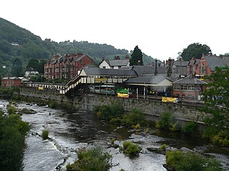
The Dee at Llangollen |
||
| Data | ||
| location |
|
|
| source | on the eastern slope of the Dduallt 52 ° 49 ′ 54 ″ N , 3 ° 45 ′ 45 ″ W |
|
| Source height | approx. 450 m | |
| mouth | Northwest Chester in the Irish Sea Coordinates: 53 ° 20 ′ 17 " N , 3 ° 12 ′ 57" W 53 ° 20 ′ 17 " N , 3 ° 12 ′ 57" W. |
|
| Mouth height | 0 m | |
| Height difference | approx. 450 m | |
| Bottom slope | approx. 4.1 ‰ | |
| length | 110 km | |
| Catchment area | 1,816.8 km² | |
| Drain |
MQ |
29.71 m³ / s |
The Dee , in Welsh Afon Dyfrdwy , is an approximately 110 km long river in northern Wales that flows into the Irish Sea .
The Dee rises in County Gwynedd on the slopes of Dduallt in Snowdonia and flows a short way to Lake Bala . From there, the course of the river turns northeast to the village of Corwen and then eastwards past Llangollen . In the valley of Llangollen the Dee flows under the Pontcysyllte aqueduct built by Thomas Telford in 1805 for the Llangollen Canal .
After the Dee leaves the Welsh mountain region, it winds northwards through the Cheshire Plain towards Chester ; beyond Chester the course of the river was channeled. The mouth of the Dee is a 19 km long and 8 km wide estuary , very shallow, with sandbanks and marshes ; the main town at the estuary is Flint .
Web links
Individual evidence
- ↑ National Water Archive , Chester Weir Station ( Memento of the original dated February 12, 2007 in the Internet Archive ) Info: The archive link was automatically inserted and not yet checked. Please check the original and archive link according to the instructions and then remove this notice.
