Dekemhare
| دقمحري Dekemhare |
||
|---|---|---|
|
|
||
| Coordinates | 15 ° 4 '10 " N , 39 ° 2' 40" E | |
| Basic data | ||
| Country | Eritrea | |
| Debub | ||
| ISO 3166-2 | ER-YOU | |
| height | 2050 m | |
| surface | 10 km² | |
| Residents | 32,000 (2004) | |
| density | 3200 Ew. / km² | |
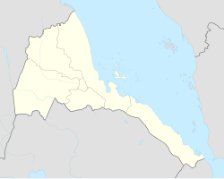
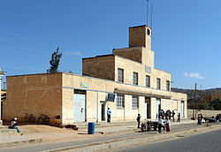
Dekemhare ( Arabic دقمحري) is a city in Eritrea with about 32,000 inhabitants (as of 2004). It has an area of 10 km² and is located about 38 km south of the capital Asmara , in the Debub region . The inhabitants belong to the Tigre , Tigrinya and Saho ethnic groups and are partly Muslim and partly Christian .
The city is located at 2050 m and therefore has a moderate climate for the region with an annual rainfall of 570 mm. Because of this climate, which is well suited for fruit and wine growing , Dekemhare was specifically developed by the Italians during the colonial period from 1920 into a center of the food industry . This center is still today.
Dekemhare has pursued a targeted settlement policy for industrial companies since the 1990s, so that the city is now an important industrial city. Among other things, the Eritrean company Tesimadas produces buses, transport, cleaning and garbage trucks there .
In the final phase of Eritrea's War of Independence from Ethiopia , the ultimately decisive encirclement of today's capital began on May 19, 1991 in Dekemhare. Dekemhare was badly affected.
Sons and daughters of the town
- Joe Castellano (* 1937), American medic and racing car driver
- Zeudi Araya (* 1951), Eritrean actress and beauty queen , mainly in Italy worked
Web links
- Homepage of the library of Dekemhare with a description of the city ( memento of September 29, 2007 in the Internet Archive ) ( English )

