Diamir (district)
|
Diamir district ضلع دیامر |
|
| State : |
|
| Province : | Gilgit-Baltistan |
| Founded : | 1974 |
| Seat : | Chilas |
| Coordinates : | 35 ° 26 ' N , 73 ° 57' E |
| Area : | 7th 234 km² |
| Residents : | 214,000 (2013) |
| Population density : | 30 inhabitants per km² |
| Time zone : | PST ( UTC + 5 ) |

|
|
The Diamir district is a district of the autonomous region of Gilgit-Baltistan , the former Northern Areas , in the north of Pakistan .
location
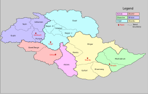
It covers a high mountain landscape in the Karakoram and western Himalayas . This district can be reached on the Karakoram Highway . The administrative headquarters are in Chilas . The Diamir district borders the Astore district to the east . This was removed from the Diamir district in 2004. In the southwest, the Diamir district is reached through the Babusar Pass , in the south it borders on the Nilam district of Asad Kashmir . The Ghizer district is located in the north and north-west. The Gilgit district borders Diamir to the north and northeast.
Before the Karakoram Highway was completed, the district was only accessible via Gilgit and from the south via a dirt road from Balakot and the Babusar Pass. The way led via Kaghan , Naran , Besal , and Gittidas through Babusar to Chilas. The road from Besal to the Babusar Pass is only accessible with four-wheel drive vehicles . A new road project from Thelichi to Skardu via Chilas and Deosai is to shorten the route between Astore and Skardu.
The Nanga Parbat is also called Diamar , the "King of the Mountains"; the second highest mountain in Pakistan and the ninth highest in the world, is located in the Diamir district.
Diamer Bhasha Dam
On March 17, 2006, Pervez Musharraf laid the foundation stone in Bhasha for the project of the 270-meter-high Diamer-Basha dam , which is to provide electricity and water and to dam the Indus . This dam is controversial as it will lead to the evacuation of 32 villages and 30,000 people. The dam would flood 12,779 km² of barren and 647 km² of arable land. Furthermore, the government of Pakistan is accused of having the construction of the dam not in their own but in the political sphere of Jammu and Kashmir .
Religion and language
The districts of Chilas and Darel / Tangir of the Diamir district are 100% religiously dominated by the Sunnis . The Shina language is also spoken in Diamir, but the Balti dialect, a dialect of the Ladakhi and Tibetan language group, is spoken here and all over Baltistan .
Others
The Muttath and Tattoo valleys in the Diamir district, which are about 60 km from Gilgit , were hit by a strong earthquake at the end of 2002, which caused severe damage. From these valleys, in which there are 14 villages and around 3,100 residents, about half had to be evacuated to Gonar Farm to a tent camp 28 kilometers from Chilas. On October 8, 2005, another major earthquake struck this area.
Web links
- Karakoram province or Gilgit-Baltistan on forums.opendemocracy
- Distribution of Religions in Northern Pakistan
Individual evidence
- ↑ a b Karakoram province or Gilgit-Baltistan ( page no longer available , search in web archives ) Info: The link was automatically marked as defective. Please check the link according to the instructions and then remove this notice. , accessed December 31, 2009
- ^ Message on Arab News , accessed December 31, 2009
- ↑ Seema Shekhawat: The Basha Dam controversy on dailyexcelsior.com ( Memento of the original from April 8, 2007 in the Internet Archive ) Info: The archive link was automatically inserted and not yet checked. Please check the original and archive link according to the instructions and then remove this notice. , accessed December 31, 2009
- ↑ Information from unicef.org , accessed on December 31, 2009
