Dietzenley
| Dietzenley | ||
|---|---|---|
|
Observation tower on the Dietzenley |
||
| height | 617.6 m above sea level NHN | |
| location | Vulkaneifel district , Rhineland-Palatinate , Germany | |
| Mountains | Vulkaneifel | |
| Coordinates | 50 ° 12 '9 " N , 6 ° 40' 40" E | |
|
|
||
| Type | volcano | |
| rock | basalt | |
| particularities | Lookout tower on the summit | |
The Dietzenley in the Vulkaneifel district in Rhineland-Palatinate is 617.6 m above sea level. NHN 's highest mountain to Eifel belonging Pelmer forest.

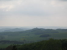
View from the tower to the old Voss
The Dietzenley rises in the Vulkaneifel Nature Park in the district of Gerolstein north above the Gerolsteiner district Büscheich-Niedereichholz .
On the mostly wooded hilltop there is a small, wooden lookout tower that offers a good view of the Vulkaneifel. A little below there is a converter and the remains of a Celtic ring wall .
From Gerolstein, Pelm and Gees , the Dietzenley can be reached on hiking trails. The 10th stage of the Eifelsteig long-distance hiking trail leads from Gerolstein over the summit to Daun .
Individual evidence
- ↑ a b Map service of the landscape information system of the Rhineland-Palatinate Nature Conservation Administration (LANIS map) ( notes )
- ^ Eifelsteig stage 10 on the website of Eifel Tourismus (ET) GmbH

