Drevenica
| Drevenica | ||
|
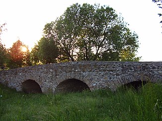
Stone bridge in Nová Ves nad Žitavou |
||
| Data | ||
| location | Slovakia | |
| River system | Danube | |
| Drain over | Žitava → Nitra (river) → Waag → Danube → Black Sea | |
| source | Tribeč | |
| Source height | 545 m nm | |
| muzzle | near Nová Ves nad Žitavou in the Žitava coordinates: 48 ° 16 ′ 38 ″ N , 18 ° 18 ′ 40 ″ E 48 ° 16 ′ 38 ″ N , 18 ° 18 ′ 40 ″ E |
|
| Mouth height | 150 m nm | |
| Height difference | 395 m | |
| Bottom slope | 17 ‰ | |
| length | 22.7 km | |
| Right tributaries | Jelenský potok, Bocegaj | |
The Drevenica is a 22.7 kilometer long tributary of the Žitava in western Slovakia . Its water flows to the Danube via the Nitra and the Waag .
The Drevenica rises in the Tribetz Mountains (Slovak: Tribeč) south of the Veľký Tribeč (830 m) at a source height of around 545 m and then flows over Kostoľany pod Tribečom , Ladice and Neverice in a south-south-east direction past Beladice and further south to the south from Nová Ves nad Žitavou flows into the Žitava at an altitude of around 150 m.
Web links
- Plán manažmentu povodňového rizika v čiastkovom povodí Váhu (PDF, 57.5 MB, Slovak, p. 98)
