Dzielnica XVIII Nowa Huta
| Kraków Dzielnica XVIII Nowa Huta |
||
|---|---|---|
 District of Krakow District of Krakow
|
|
|
| Basic data | ||
| State : | Poland | |
| Voivodeship : | Lesser Poland | |
| District of: | Krakow | |
| Area : | 65.41 km² | |
| Geographic location : | 50 ° 4 ' N , 20 ° 7' E | |
| Residents : | 50,392 (2019) | |
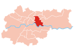
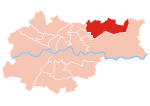
Dzielnica XVIII Nowa Huta is the eighteenth district of Krakow in Poland , it covers an area of 65.41 km² and has 50,392 inhabitants with a population density of 770.4 inhabitants / km². It is named after the socially realistic workers' town , built between 1949 and 1951, and the Nowa Huta ( New Hut ) ironworks combine of the same name .
The district emerged gradually from 1951 to 1954 and initially had 76.4 km². The population increased through the construction of numerous prefabricated housing estates from 101,000 in 1960 to 174,000 in 1970, making it the largest of the 6 city districts of Krakow. In 1973 and 1986 the city district was enlarged to 110.7 km² by incorporation into Krakow in the east. In 1990 it had 224,000 inhabitants, but was then divided into five smaller districts.
structure
- Błonie
- Branice
- Center A
- Center B
- Center C
- Center D
- Center E
- Chałupki
- Chałupki Górne
- Cło
- Górka Kościelnicka
- Holendry
- Kopaniny
- Kościelniki
- Kujawy
- Mogiła
- Nowa Wieś
- Osiedle Górali
- Osiedle Handlowe
- Osiedle Hutnicze
- Osiedle Kolorowe
- Osiedle Krakowiaków
- Osiedle Lesisko
- Osiedle Młodości
- Osiedle na Skarpie
- Osiedle Ogrodowe
- Osiedle Słoneczne
- Osiedle Sportowe
- Osiedle Spółdzielcze
- Osiedle Stalowe
- Osiedle Szklane Domy
- Osiedle Szkolne
- Osiedle Teatralne
- Osiedle Urocze
- Osiedle Wandy
- Osiedle Willowe
- Osiedle Zgody
- Osiedle Zielone
- Piekiełko
- Pleszów
- Przylasek Rusiecki
- Przylasek Wyciąski
- Ruszcza
- Stryjów
- Wola Rusiecka
- Wolica
- Wróżenice
- Wyciąże
Townships
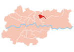
The Nowa Huta district was subdivided into five administrative districts in 1991. The population was around 194,000 at the end of 2019.
| District number / name |
Area in km² | population | Population density in inhabitants / km² | map |
|---|---|---|---|---|
| XIV Czyżyny | 12.2568 | 30,946 | 2,525 |

|
| XV Mistrzejowice | 5.5900 | 51,795 | 9,266 |

|
| XVI Bieńczyce | 3.6990 | 40,632 | 10,985 |

|
| XVII Wzgórza Krzesławickie | 23.8155 | 20,214 | 849 |

|
| XVIII Nowa Huta | 65,4099 | 50,392 | 770 |

|
Web links
- District website (Polish)
Individual evidence
- ↑ a b c d bip.krakow.pl: Liczba mieszkańców w poszczególnych dzielnicach (due to stanu on 31.12.2019) oraz powierzchnia dzielnic. - BIP, the official website of the City of Krakow. (Polish, as of December 31, 2019. Accessed July 6, 2020)
- ↑ Dissertation by Dominik Jaśkowiec EWOLUCJA ROLI DZIELNIC MIASTA KRAKOWA NA TLE ROZWIĄZAŃ KRAJOWYCH I EUROPEJSKICH W LATACH 1990-2015 , Kraków, 2018, (Polish)
- ↑ Calculated from the above figures.


