Earthquake in Peru on May 31, 1970
| Great earthquake in Peru in 1970 | ||
|---|---|---|
|
|
||
| date | May 31, 1970 | |
| Time | 20:23:29 UTC | |
| intensity | VIII on the MM scale | |
| Magnitude | 7.9 M W | |
| depth | 45 km | |
| epicenter | 9 ° 10 ′ 59 ″ S , 78 ° 44 ′ 13 ″ W | |
| country | Peru | |
| Tsunami | Yes | |
| dead | 66,794 | |
| damage | US $ 530 million | |
The great earthquake in Peru on May 31, 1970 was the deadliest earthquake disaster in the history of Peru . The quake shook the earth at 3:23 p.m. local time with a strength of 7.9 M w and caused the collapse of thousands of houses. The quake triggered a massive debris and mud avalanche that buried the city of Yungay under itself. It is estimated that around 70,000 people were killed in the natural disaster . Around 800,000 people were left homeless.
tectonics
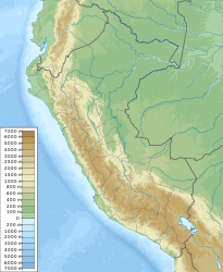
On the west coast of South America , the Nazca Plate is submerged under the South American Plate , a process known as subduction . The focus of the earthquake was a large-scale displacement , caused by the tensile forces of the descending Nazca plate. The length of the fracture surface is estimated at 130 kilometers. The epicenter of the earthquake was off the coast of the Ancash region , about 20 kilometers southeast of the port city of Chimbote . The hearth depth was 45 kilometers. The quake had a moment magnitude of 7.9 M w and was experienced with an intensity of up to level VIII. The tremors lasted for about 45 seconds. A small tsunami was triggered.
In the next few days several aftershocks occurred, the strongest of which on June 4, 1970 with a magnitude of 6.4 M w .
The mud and debris avalanche
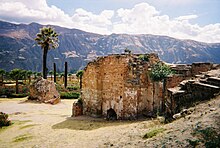
Ancash is one of the most mountainous and most geographically divided regions of Peru, with north-south running valleys on both sides of the Cordillera Blanca . Due to the tremors of the earthquake, a mud, ice and debris avalanche detached itself from the highest mountain in Peru, the Nevado Huascarán , which rushed down into the valley of the Río Santa at an average speed of 320 km / h and destroyed everything in its path. The city of Yungay was almost completely buried, only about 300 of the 20,000 inhabitants survived the disaster. Also the place Ranrahirca was hit hard. The debris flow then flowed down the valley of the Río Santa, devastating villages and fields and destroying a tipping structure of the Cañón del Pato hydropower plant , which was only able to resume operations in 1978.
Victims and damage
The worst hit areas were the Ancash region and parts of the neighboring La Libertad , Huánuco and Lima regions .
It is estimated that around 70,000 people were killed in the earthquake. The number of injured people is estimated at between 50,000 and 150,000.
Damage occurred in more than 2000 cities and villages. Thousands of adobe houses collapsed in the highlands . Serious damage also occurred on the coast, where around 65 percent of the buildings and roads were structurally impaired. Numerous traffic routes were interrupted by landslides and rockfalls. Electricity generation capacities in the Ancash and La Liberdad regions were reduced by 90 percent.
Help and reconstruction
Large amounts of aid and supplies arrived from abroad and helpers traveled to the affected areas. Up until 1982, many NGOs and other countries made aid payments, and the US Food-for-Peace program continued beyond that.
Coastal cities were supplied with food and relief supplies by naval ships. The government declared a tax moratorium and temporarily expropriated all of the land in the affected region to make reconstruction easier. In Lima , a commission for aid and reconstruction of the affected region was founded at the beginning of June 1970, which (accompanied by numerous name changes) remained in existence until 1986. In 1971 it moved its headquarters to Vichay near Huaraz . By 1972, most of the rubble had been removed from the larger cities. In the years to come, streets were paved, new housing projects built and entire settlements rebuilt. Huaraz flourished as a result of the reconstruction and a new airport was built near the city. However, decades later, numerous families lived in emergency shelters or received no support in building new houses. There were also problems with poorly planned or poorly built houses and roads, as well as poorly thought-out relocation projects. Reconstruction has been most successful where communities were supported by the central government or foreign organizations, but took the planning and control into their own hands.
The quake was the decisive factor for the establishment of the Peruvian civil protection authority Instituto Nacional de Defensa Civil (INDECI) in 1972. The great earthquake of 1970 is commemorated annually with a tsunami and earthquake exercise.
literature
- Lloyd S. Cluff: Peru earthquake of May 31, 1970; engineering geology observations. In: Bulletin of the Seismological Society of America. Volume 61, Issue 3 June 1, 1971, pp. 511-533, digital version online (PDF; 65.2 MB) on iris.edu.
- Nathan Clarke: Revolutionizing the Tragic City: Rebuilding Chimbote, Peru, after the 1970 Earthquake. In: Journal of Urban History. Volume 41, Issue 1. 2015, pp. 93–115, DOI: 10.1177 / 0096144214552392 .
- Paul L. Doughty: Plan and Pattern in Reaction to Earthquake. Peru 1970-1998. In: The Angry Earth: Disaster in Anthropological Perspective. Routledge, Abingdon-on-Thames / New York 2020, ISBN 978-1-138-23783-4 , pp. 265-281.
supporting documents
- ↑ a b c Significant Earthquake - PERU: NORTHERN, PISCO, CHICLAYO. NOAA , accessed May 31, 2020.
- ^ Katsuyuki Abe: Mechanics and tectonic implications of the 1966 and 1970 Peru earthquakes. In: Physics of the Earth and Planetary Interiors. Volume 5. 1972, pp. 367-379, DOI: 10.1016 / 0031-9201 (72) 90108-2 (English).
- ^ M 7.9 - near the coast of northern Peru. USGS, accessed May 31, 2020.
- ↑ a b c In pictures: Peru's most catastrophic natural disaster. In: bbc.com . May 31, 2020, accessed on May 31, 2020.
- ↑ Nearby Seismicity - Search Results. USGS, accessed May 31, 2020.
- ↑ a b c d Rosa Muñoz Lima: 50 años tras el terremoto de Áncash: ¿qué aprendió Perú? In: dw.com May 28, 2020, accessed July 7, 2020 (Spanish).
- ↑ cf. Lloyd S. Cluff: Peru earthquake of May 31, 1970; engineering geology observations. P. 511.


