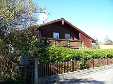
Ettenkofen (Tunzenberg)

Ettenkofen is a hamlet in the district Tunzenberg the community Mengkofen in Lower Bavaria Dingolfing-Landau .
geography
Ettenkofen is located to the right (south) of the Aiterach and mainly north of the state road 2141, around 1300 meters northeast of the center of Mengkofen. Center of the village is the inn Gasthof zum Sepp . The industrial area Ettenkofen (with Ettenkofen II) extends south along the state road over a length of almost 600 meters .
In church terms, Ettenkofen belongs to the Roman Catholic parish Martinsbuch .
history
Ettenkofen used to belong to the Hofmark Tunzenberg. However, one house belonged to the Hofmark Hofdorf , according to Joseph von Hazzi (1808) to Krilſperg .
With the formation of the community in 1818, Ettenkofen, like the neighboring Dengkofen, initially became a separate community. This was also the former farmstead (a house and a hearth ) Auholz assigned to that used for Hofmark Geltolfing part and then into the court Straubing incorporiert was.
Like Dengkofen, the Ettenkofen community was dissolved in 1824 and incorporated into the Tunzenberg community, which in turn was incorporated into Mengkofen on January 1, 1971. On the cut-off date of the census of May 25, 1987 Dengkofen had 79 inhabitants in 21 buildings with living space with 27 apartments.
Attractions
Ettenkofen has two listed residential buildings, with house numbers 1 and 7.
Individual evidence
- ↑ Bernd Stadlbauer: The Altland District Dingolfing. = Historical Atlas of Bavaria / Part of Old Bavaria. Series I, Volume 65, Munich 2015, ISBN 978-3-7696-6557-4 , p. 335
- ^ Mengkofen community: History of Hofdorf
- ↑ Joseph von Hazzi: Statistical information about the Duchy of Baiern, drawn from genuine sources. A general contribution to the country u. Human studies. Fourth volume. Nuremberg 1808, p. 240
- ↑ a b Bernd Stadlbauer: The old district of Dingolfing. = Historical Atlas of Bavaria / Part of Old Bavaria. Series I, Volume 65, Munich 2015, ISBN 978-3-76966-557-4 , p. 399
- ↑ Joseph von Hazzi: Statistical information about the Duchy of Baiern, drawn from genuine sources. A general contribution to the country u. Human studies. Fourth volume. Nuremberg 1808, p. 238
- ^ Official register of places for Bavaria, territorial status: May 25, 1987, Munich, 1991 , p. 173
Coordinates: 48 ° 44 ' N , 12 ° 27' E

