Exmouth (Western Australia)
| Exmouth | |||||||
|---|---|---|---|---|---|---|---|
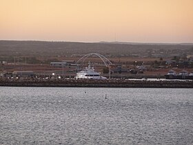
 Exmouth Harbor |
|||||||
|
|||||||
|
|||||||
|
|||||||
|
|||||||
|
|
|||||||
Exmouth is a place in Western Australia with about 2,200 residents. It was founded in 1964 and named after Admiral Exmouth who explored the area in 1818. Located at the tip of the Vlaming Head Peninsula, the city was built as a service center for the nearby United States Naval Communication Station Harold E. Holt , whose transmission towers are among the tallest in the world (they are with a height of 388 meters higher than the Eiffel Tower ).
Tourism and economy

Exmouth also lives off the exploitation of the oil fields off the west coast of Australia.
| Exmouth | ||||||||||||||||||||||||||||||||||||||||||||||||
|---|---|---|---|---|---|---|---|---|---|---|---|---|---|---|---|---|---|---|---|---|---|---|---|---|---|---|---|---|---|---|---|---|---|---|---|---|---|---|---|---|---|---|---|---|---|---|---|---|
| Climate diagram | ||||||||||||||||||||||||||||||||||||||||||||||||
| ||||||||||||||||||||||||||||||||||||||||||||||||
Tourists come to Exmouth because of the Cape Range National Park to the west and the Ningaloo Reef off the coast . This is considered an excellent diving area and you can watch whale sharks , humpback whales and manta rays there .
history
During the Second World War , facilities were established here to support the submarine war against Japan. Numerous monuments and information boards testify to this era in the city and the surrounding area. On May 20 and 21, 1943, several Japanese bombs fell near the Exmouth radar station at night without harming people or causing property damage.
In 1953, oil discoveries at Rough Range were made by the prospecting company WAPET, now Chevron.
On October 8, 2008, a Qantas Airways aircraft , an Airbus A330-300 , with 313 people on board was able to make an emergency landing at the local military airfield after a near-crash. The 12 seriously injured passengers were flown out from there for treatment.
Exmouth Bay
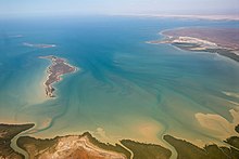
The Exmouth Bay (English Exmouth Gulf ) with Gales Bay is located between the North West Cape and the main coastline of Western Australia.
Web links
- Description of the city, the surrounding area and its sights on "australien-info.de"
- Images of Exmouth and the Cape Range National Park
- Website of the Shire of Exmouth (English)
- Learmonth Airfield (RAAF Museum Exmouth )
Individual evidence
- ^ Australian Bureau of Statistics : Exmouth (Urban Center / Locality) ( English ) In: 2016 Census QuickStats . June 27, 2017. Retrieved April 7, 2020.
- ↑ Bureau of Meteorology, Australia: Klimainformationen Exmouth. World Meteorological Organization, accessed April 6, 2012 .
- ↑ https://www.ozatwar.com/japsbomb/bombexmouth01.htm
