Ferreñafe
| Ferreñafe | |
|---|---|
|
Coordinates: 6 ° 38 ′ S , 79 ° 47 ′ W
Ferreñafe on the map of Peru
|
|
| Basic data | |
| Country |
|
| region | Lambayeque |
| province | Ferreñafe |
| City foundation | December 13, 1550 |
| Residents | 33,526 (2017) |
| City insignia | |
| Detailed data | |
| height | 67 m |
| Time zone | UTC -5 |
| City Presidency | Violeta Patricia Muro Mesones (2019-2022) |
| Website | |
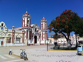
| Iglesia de Santa Lucía | |
Ferreñafe is the capital of the Ferreñafe Province in the Lambayeque region in northwestern Peru . The city is located in the district of the same name . At the 2017 census it had 33,526 inhabitants, 10 years earlier the number of inhabitants was 31,777.
The city is located in the desert, arid coastal plain of northwestern Peru at the foot of the foothills of the Andes at an altitude of 67 m . The Pacific coast is at a distance of 25 km. The metropolis of the region, Chiclayo , is 15 km south-southwest of Ferreñafe, the city of Lambayeque 15 km west-southwest. Irrigated agriculture is practiced in the vicinity of Ferreñafe. Several irrigation canals lead from the mountains of the Peruvian Western Cordillera to the Ferreñafe area.
The city was founded by Alonso de Osorio on December 13, 1550. In Ferreñafe there is the Museo Nacional Sicán , which deals with the Sicán culture (approx. 700 to 1375).
Individual evidence
- ^ Peru: Lambayeque Region - Provinces & Places . www.citypopulation.de. Retrieved January 5, 2020.


