
Flüela Wisshorn
| Flüela Wisshorn | ||
|---|---|---|
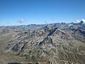
.jpg) Flüela Wisshorn, recorded from the Büelenhorn |
||
| height | 3085 m above sea level M. | |
| location | Canton of Graubünden , Switzerland | |
| Mountains | Silvretta | |
| Dominance | 3.42 km → Schwarzhorn | |
| Notch height | 628 m ↓ Pass da Fless | |
| Coordinates | 793.19 thousand / 182249 | |
|
||
| First ascent | C. Nussberger and Chr. Guler on January 12, 1902 with snow tires | |
| Normal way | From the winter gap , over the NW ridge | |
| particularities | Popular ski mountain | |

The Flüela Wisshorn ( Swiss German for Flüela Weisshorn where Flüela diminutive of Fluh , Swiss German Flueh for 'rock face, rocky area') is a mountain northeast of the Flüela Pass in the canton of Graubünden in Switzerland with an altitude of 3,085 m above sea level. M. It is the highest point in the Flüela group. From Vereina the mountain appears as a beautifully shaped pyramid, from the Flüelapassstrasse, on the other hand, you see it as an imposing, steeply rising wall with a horizontal, somewhat jagged summit ridge.
Location and surroundings

The Flüela Wisshorn belongs to the Flüela Group, a subgroup of the Silvretta . The municipal boundaries of Davos , Klosters-Serneus and Zernez meet at the summit . The Flüela Wisshorn is located at the back of the Jörital and is bordered by the Flüela valley to the west and by the Val Susasca to the south.
The neighboring peaks include the Jörihorn , the Muttelhorn and Rosställispitz , the Piz Champatsch , the Piz Radönt and the Schwarzhorn .
On the north flank, the Flüela Wisshorn has a glacier, the Jörigletscher.
The valley locations are Davos and Susch. Frequent starting points are Wägerhus on the Flüelapassstrasse, the Flüela-Ospiz or the Berghaus Vereina.
Rock fall 2019

On the night of March 19, 2019, shortly after midnight, a rock fall with more than 250,000 cubic meters of rock came off the northwest flank of the Flüela Wisshorn. The rock fall triggered a snow avalanche, which only stopped shortly before the pass road to the Flüelapass . The reason for the rock fall was probably the erosion and the melted glacier.
Routes to the summit
Summer routes
From the winter gap over the northwest ridge


- Starting point: Berghaus Vereina ( 1943 m ) or Wägerhus ( 2207 m , north of the Flüelapass)
- Via: Winterlücke ( 2785 m )
- Difficulty: WS
- Time required: 4 hours from Berghaus Vereina, 3 hours from Wägerhus or 1 hour from Winterlücke
From the Flüelapass, over the northwest ridge
- Starting point: Flüela-Ospiz ( 2383 m )
- Difficulty: WS
- Time required: 3 hours
From Berghaus Vereina, over the northeast ridge
- Starting point: Berghaus Vereina ( 1943 m )
- Difficulty: ZS
- Time required: 4-4½ hours
- Special: ascent of the Jöri Glacier
From the Flüelapass, through the east wall
- Starting point: Flüela-Ospiz ( 2383 m )
- Difficulty: WS
- Time required: 3½ hours
From the Flüelapass, over the entire southwest ridge
- Starting point: Flüela-Ospiz ( 2383 m )
- Difficulty: ZS
- Time required: 3½-4½ hours
From the Flüelapass, over part of the southwest ridge
- Starting point: Flüela-Ospiz ( 2383 m )
- Difficulty: ZS
- Time required: 3½ hours
From the Wägerhus, over the west ridge
- Starting point: Wägerhus ( 2207 m , north of the Flüelapass)
- Difficulty: S
- Time required: 3½-4 hours
Winter routes
The highest peak in the long ridge north of the Flüela Pass is popular thanks to its beautiful view and the various downhill options. As early as January 12, 1902, E. Nussberger and Chr. Guler climbed the Weisshorn with snow tires and skis on their shoulders. The ascent to the summit is too full and can be tricky if it is iced over.
From Tschuggen

- Starting point: Tschuggen ( 1964 m )
- Via: Rossboden, Winterlücke ( 2785 m ), Jörigletscher, northeast ridge of the pre-summit
- Note: ski depot on the northeast ridge
- Exposures: SW, N
- Difficulty: WS +
- Time required: 4 hours
From Berghaus Vereina
- Starting point: Berghaus Vereina ( 1943 m )
- Via: Jöriseen ( 2489 m ), Jörigletscher, northeast ridge of the pre-summit
- Note: ski depot on the northeast ridge
- Exposures: N
- Difficulty: WS +
- Time required: 4 hours
From Chant Sura
- Starting point: Chant Sura ( 2176 m )
- Via: Tantermozza Chant Sura , P. 2941, northeast ridge of the pre-summit
- Exposures: S, E
- Difficulty: ZS-
- Time required: 3 hours
Lingerie round tour
Worthwhile descent variant with a counter slope to the laundry chuchi.
- Destination: Tschuggen ( 1964 m )
- Via: Jörigletscher, Jöriseen ( 2489 m ), P. 2771 (Waschchuchi), Müllersch Tälli
- Exposures: N, SE, SW
- Difficulty: WS +
panorama

gallery

North view of the Flüela Wisshorn with the Jöri Glacier, taken from the Jöriseen .
Flüela Wisshorn, taken from the Schwarzhorn .

View of the Jöriseen , in the background the Jörital and Vereina.


literature
- Bernard Condrau: Club Guide, Bündner Alpen, Volume 8 (Silvretta and Samnaun) 3rd edition. Verlag des SAC, 1985, ISBN 3-85902-048-X , pp. 192-196.
- Georg Calonder: Alpine Skitouren, Volume 2 (Graubünden) 4th edition. Verlag des SAC, 1992, ISBN 3-85902-060-9 , pp. 299-300.
- Vital Eggenberger: Ski tours Graubünden South . Verlag des SAC, 2010, ISBN 978-3-85902-301-7 , pp. 229-232 .
- National map of Switzerland, sheet 1197 Davos, 1: 25000, Federal Office for Topography, 1985 edition
Web links
Individual evidence
- ↑ Andrea Schorta: How the mountain got its name . Small Rhaetian name book with two and a half thousand geographical names of Graubünden. Terra Grischuna Verlag, Chur and Bottmingen / Basel 1988, ISBN 3-7298-1047-2 , p. 87 .
- ↑ Rockslide and avalanche on the Flüela Wisshorn.Retrieved on August 26, 2020