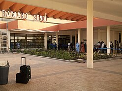
Bamako airport
| Bamako airport
Aéroport international de Bamako-Sénou |
||
|---|---|---|
|
|
||
| Characteristics | ||
| ICAO code | GABS | |
| IATA code | BKO | |
| Coordinates | ||
| Height above MSL | 380 m (1247 ft ) | |
| Transport links | ||
| Distance from the city center | 10 km south of Bamako | |
| Basic data | ||
| operator | Aéroports du Mali (short: ADM) | |
| Start-and runway | ||
| 06/24 | 2706 m × 45 m asphalt | |
The Bamako Airport ( english Bamako Sénou International Airport , French Aéroport international de Bamako Sénou ) is an airport of Bamako in Mali .
location
The airport is located near the city of Bamako.
The tower (TWR) sends and receives on the frequency 118.3 MHz . The airport has various navigation aids. The runway 06/24 has an instrument landing system (ILS). The non-directional radio beacon (NDB) transmits on the frequency 301 kHz with the identifier BM . The rotating radio beacon (VOR) transmits on frequency 113.7 MHz with the identifier BKO . A distance measuring equipment (DME) is present.
Airlines and Destinations
The following airlines currently fly to Bamako:
- Aigle Azure
- Royal Air Maroc
- Asky Airlines
- Ethiopian Airlines
- Air France
- Air Côte d'Ivoire
- Mauritania Airlines International
- Kenya Airways
- Turkish Airlines
- ECAir
- Tunisair
- Air Burkina
- Cargolux
- Air Algérie
Incidents
According to ASN , three fatal accidents have been reported near the airport.
- On July 24, 1971, an Air Ivoire Douglas C-47 A-90-DL had an accident near the airport shortly after take-off. All six inmates were killed.
- On May 31, 1981, an Algerian government aircraft of the Dassault Falcon 20 C type crashed while approaching in bad weather. Three of the six inmates were killed. Algerian Foreign Minister Mohamed Seddick Benyahia survived the accident.
- On 21 June 1983 proposed a De Havilland Canada DHC-6 Twin Otter of Air Mali about five kilometers from the airport runway on. All seven inmates were killed.
Web links
- Airport website (French)
- Airport data in the Aviation Safety Network (English)
- Airport data on World Aero Data ( 2006 )
- Airport details In The Airport Guide
Individual evidence
- ↑ Airport data on World Aero Data ( English, as of 2006 )
- ↑ Airport data in the Aviation Safety Network (English)
- ↑ Aircraft accident data and report of the accident of July 24, 1971 in the Aviation Safety Network (English)
- ↑ Aircraft accident data and report of the accident of May 31, 1981 in the Aviation Safety Network (English)
- ^ Aviation Safety Network, TZ-ACH, June 21, 1983


