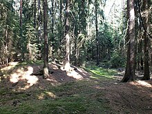
Forchheim (Feisnitz)
Forchheim was a village between Seedorf and Pechtnersreuth , which was described as deserted when it was first mentioned in 1340 .
geography
The place where Forchheim was located is near the border area of Upper Franconia , Upper Palatinate and the Czech Republic in the Kohlwald near the Feisnitz spring on the southern slope of the Oberkunreuthberg (656 m). The site was localized by excavations at 50 ° 03.3 'north latitude and 12 ° 16.4' east longitude.
history
The name Forchheim is to be understood as a settlement on or in the coniferous forest and was first mentioned in 1340 in a sales contract as Vorchaim . At this point, Forchheim was already a desert :
"From the monastery Waldsassen the purchase in 1340 Egerer citizens Walther Hofer and his sons Jacob and Niklas a one-time sum of the desolate village Vorchaim for jointure what Heindrich Elder, bailiff of Weida, the time keepers of the Cheb region, and the Council (of the city of Eger) on November 25th. ” According to other sources, the village was only destroyed in 1369.
It can be assumed that the iron ore deposits in the immediate vicinity, the existing forest for iron smelting and the rich clay deposits in this area were used to build racing furnaces and were the reason for the establishment of the town.
Forchheim was mentioned again in 1362 when a captain of the Egerland, Bohuslaw von Schwanberg , had a trench drawn from Reutlas near Marktredwitz to Forchheim as a demarcation .
The end of the place is likely due to an economic crisis in the mining industry. Excavations in the middle of the 20th century suggest a brief revival around the year 1400. Since then, Forchheim has completely disappeared without leaving any settlement residue.
Excavations
During a reforestation in 1960, fragments of medieval vessels were found, the oldest of which can be dated to before 1000, the youngest to 1400. Around 200 meters southeast of the Forchheim settlement near the Feisnitz source, the remains of a rectangular weir system, consisting of a tower hill and a moat surrounded by a wall, were found.
Individual evidence
- ^ Gradl, Heinrich (1893): "History of the Egerland until 1437", Prague, p. 182
- ^ Gradl, Heinrich (1893): "History of the Egerland until 1437", Prague, p. 225
literature
- Friedrich Wilhelm Singer : The desert "Forchheim" in the Kohlwald near Arzberg . In: Archive for the history of Upper Franconia 51, 1971, ISSN 0066-6335 , pp. 5-38.
- Heinrich Gradl : History of the Egerland (until 1437) . Dominicus, Prague 1893.
Coordinates: 50 ° 3 ′ 18 ″ N , 12 ° 16 ′ 24 ″ E

