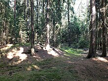
Forchheim I tower hill
The Forchheim I tower hill is located in the Forchheim desert in the Münchenreuth district of the Upper Palatinate town of Waldsassen in the Tirschenreuth district . The Forchheim II tower hill is located about 20 m southeast of it . Both tower hill castles are located in the Münchenreuther Wald.
history
The disappeared settlement Forchheim lies on an old road to Eger mentioned in 1061 . The area was interesting from an economic point of view, as clay and red iron deposits were located here.
This hilltop castle belonged to a family of ministers from Eger who are not known by name and from whom the Waldsassen monastery bought the town of Forchheim. In 1340 the councilor and caretaker of Eger testified that the Eger citizen Walther Höfer and his sons Jakob and Niklas bought the deserted village of Vorchain from the Waldsassen monastery for lifelong use. In 1341 a Heinrich Forchheimer became the sealer of a certificate of emergency . Various iron hammers belong to this Heinrich . In 1358 Niklas Walther is named as the lifelong owner of Forchheim. In 1362 Forchheim appears as the end of a border ditch that Bohuslav von Schwanberg drew from Reutlas to Forchheim on behalf of Emperor Charles IV . In 1396 the destruction of this settlement is mentioned. Further destruction is also reported for 1434 and 1439 ( desertum Vorcheim ). The monastery judge of Griesbach near Bärnbach is said to have sold Forchheim to the Waldsassen monastery. The monastery enfeoffs Melchior Gefeller with Forchheim with the request to rebuild the place, which he does not do. In 1485 he again undertook to rebuild and was given the right to buy the wasteland. He uses this right to sell parts of it to Hans Seidel from Wernersreuth and to the church in Münchenreuth. The reconstruction itself will not take place.
Location and appearance
The tower hill is about 2 km north-northwest of the church of Münchreith or near the Kebsbach. It is the much smaller fortification. The hill measures approx. 5 × 6 m and rises over a rectangular moat (11 × 12 m). To the south, this ditch turns into a slope. Shards with wavy ribbons were found on its plateau, which belong to earlier German or Slavic ceramics from the 7th to 10th centuries.
literature
- Ulrich Kinder (2013): The fortifications in the Tirschenreuth district . (= Work on the archeology of southern Germany. Volume 28), (pp. 165–168). Dr. Faustus, Büchenbach. ISBN 978-3-933474-82-7 .
Coordinates: 50 ° 3 ′ 18 ″ N , 12 ° 16 ′ 24 ″ E


