Gautier (Mississippi)
| Gautier | ||
|---|---|---|
|
|
||
| Coordinates | 30 ° 23 '21 " N , 88 ° 36' 37" W | |
| Basic data | ||
| Country | United States | |
| Mississippi | ||
| ISO 3166-2 | US MS | |
| height | 2 m | |
| surface | 33.5 km² | |
| Residents | 18,572 ( 2010 ) | |
| density | 554.4 Ew. / km² | |
| Website | gautier-ms.gov | |
| politics | ||
| mayor | Phil Torjusen | |
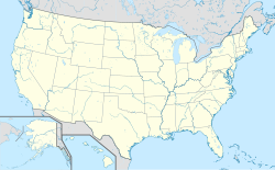
Gautier is a city in Jackson County in the US state of Mississippi and is located at the mouth of the Pascagoula River in the Gulf of Mexico , about 250 kilometers southeast of the capital Jackson . The place is part of the Pascagoula metropolitan area .
The town was named after Fernando Upton Gautier , who built the sawmill "Fernando Gautier & Sons" on the west side of the Pascagoula River in 1867 and thus ensured growth in this region.
The nearest airport is Trent Lott International Airport a few miles northeast of the city, near Escatawpa .
Demographics
At the 2010 census , the city had 18,572 inhabitants. Until 2014 the number remained more or less constant at around 18,596 inhabitants, of which around 58% were white and around 32% black, Hispanics (5.3%) and Asians (1.5%) made up the largest minorities. Overall, Southaven's population grew by 59.2% between 2000 and 2014.
Personalities
- Fernando Upton Gautier (1822–1891), sawmill owner and namesake
- Margie Joseph (* 1950), soul and R&B singer
- Kez McCorvey (born 1972), American football player
photos
Gautier School , listed on the National Register of Historic Places
Web links
- The city's website ( English )
Individual evidence
- ↑ Our History & Folklore , on gautier-ms.gov. Retrieved April 23, 2018.
- ↑ Gautier, Mississippi , on city-data.com (English). Retrieved April 23, 2018.
- ↑ Fernando Upton Gautier , on findagrave.com. Retrieved April 23, 2018.


