
Gavrinis
Gavrinis ( Breton: Gavriniz , Old Breton: Guirv Enes 1184 and Guerg Enes 1202) is a small island in the Gulf of Morbihan ( Breton : small sea ) in Brittany ( France ), which is known for one of the most important megalithic monuments in Europe. The Neolithic building was declared a Monument historique in 1901 .

location
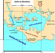
The uninhabited island lies between Locmariaquer and Larmor-Baden . At the time of the construction of the Allée couverte and the circular Cairns, the post-glacial sea level was about five meters lower, so that Gavrinis - as well as the nearby island of Er Lannic with its stone circles - was connected to the mainland. Gavrinis is developed for tourism; Boats take small groups of visitors from Larmor-Baden to the island.
- Gavrinis

General view of the approximately 8 m high Cairns . The almost circular building with a diameter of around 50 m was initially designed in three stages and was reconstructed accordingly.
location

Schematic floor plan of the chamber (left) and corridor


Building history
According to the latest studies, the age of the Gavrinis complex is about 6000 to 6200 years; The dolmen and cairn are likely to have been erected in close temporal connection with the other important buildings on the Gulf of Morbihan ( Table des Marchand , Mané Lud , Mané Rutual ), all of which were built using large fragments of destroyed large menhirs . At some point the - originally open - access to the structure was buried, later also covered by dune sand and grass. Parts of the quarry stone cairn were removed by human hands, so that when it was 'rediscovered' in 1832 it looked like a small volcanic crater; At that time the corridor could be entered from above, but it was partially blocked by sand and small stones. In contrast to the Table des Marchand, however, large parts of the structure and the entire corridor area including the Trilith portal were preserved, so that stone mounds and dolmens could be restored and made accessible to the public in the early 1980s.
function
As with many other dolmens in Brittany, there was no evidence of burial in Gavrinis, which has led to the theory that the complex may have had a function as a place of worship or meeting place. Such a function could, however, also belong to a later period, because the access probably remained unlocked for centuries, perhaps even millennia.
The attachment
Alignment
As with most passage graves in the region, the entrance is oriented to the southeast. It is unclear whether the sunrise point at the time of the winter solstice, which can be interpreted in many ways in terms of symbols, played a role. The otherwise round cairn, more than 50 m in diameter and around 8 m high, is slightly indented in the entrance area, whereby a stronger directional accentuation is achieved.
architecture
Cairn
The almost circular cairn is - possibly for reasons of stability - laid out in several stages and consists of thousands - roughly the size of bricks - rubble stones; the building rests on an approximately 70 cm high embankment made of earth, sand and small stones. While the front part of the cairn is stone-visible, the rear part was designed as a grassy mound of earth.
Passage grave
Inside the stone hill there is an allée couverte , which is one of the most beautiful complexes of the entire Neolithic period . It has an approximately 13.00 m long and approximately 0.80 m wide corridor paved with large slabs (after Mané Rutual the second longest in Brittany) with a constant head height of approximately 1.50 m, which leads to a 1.75 m high and only about six square meters large chamber (about 2.30 m × 2.55 m) leads. The supporting stones (orthostats) of the corridor and chamber are richly decorated with ornaments, the - originally probably existing - symbolic meaning of which is no longer known.
Stones
All bearing stones ( orthostats ) and the cap stones in the corridor area of Gavrinis are made of granite , which can be found in the vicinity. In contrast, the only ceiling stone of the chamber, which is slightly curved downwards and weighs around 17 tons, consists of so-called orthogneiss , which was broken in the area of Auray (around 10 km north). The stone was first used (around 4500 BC) as a menhir (see below); But this and others were overturned and broken before the construction of the Gavrinis and Locmariaquer structures - the middle section was brought here.
ornamentation


The surface of 21 of the 29 granite orthostats in the corridor and in the chamber was painstakingly smoothed over a total area of around 60 m 2 and then decorated over and over with ornaments so that no free spaces were left. Two other orthostats are only partially ornamented and thus possibly incomplete; the stones immediately behind the entrance portal remained undecorated. A large, half-ornamented stone lay flat on the floor in front of the entrance to the chamber; it was removed from the building for protection and replaced by a copy.
During the excavation and restoration work in the early 1980s, it was found that the outer surfaces of a few stones - covered by the cairn and thus invisible - were ornamented. However, the patterns differ significantly from those inside - one can therefore assume that stones were reused in the construction, the ornamentation of which had already lost their meaning.
Stone axes without a shaft (possibly wedges or daggers), crooked sticks ( báculos ), serpentine or wave-like motifs, concentric semicircles, shield shapes and herringbone or braided patterns were scored; a bow and two associated arrows can also be seen.
Two stones in the corridor are divided into rectangular fields by crossing straight lines; the concentric semi-circle ornaments, which are sometimes interpreted as 'shield idols', are subordinate to this classification. The right angles are among the earliest of their kind in world art.
The rear left supporting stone of the chamber has three conspicuous, more than fist-sized holes with webs in between - these unusual shapes are however, according to previous knowledge, as the whims of nature. Another stone inside the chamber shows more than 50 crooked bars - pointing to the right or left from the center - the shape of which, however, is less pronounced and even than the main stone of the Table des Marchand; a frame is missing.
On the reused capstone of the chamber, animals with long horns (probably cattle) can be seen as well as an object that for a long time was interpreted as an ax plow, but which can also be seen as a - highly abstract - blowing whale (cf. Mané Lud ).
Recycled standing stones
The only capstone in the chamber had long been a secret. The archaeologist C.-T. We owe Le Roux and J. L'Helgouac'h the knowledge of an important link between the Table des Marchand , Er Grah and Gavrinis. A menhir that was forcibly toppled, which was probably brought down at the same time as the Grand Menhir -Brisé and the Menhir of Mané-er-Hroek , but unlike this one, had a flat, rectangular cross-section and broke into three parts (probably centuries later). the ceiling panels for the chambers by Er Grah, Table des Marchand and Gavrinis. Evidence was provided by the coincidence of the break lines, on which in the case of the last two even an engraving was cut. The menhir was named "Menhir von Locmariaquer" and was originally located near the Grand Menhir-Brisé and was possibly part of a menhir row ( alignment ). The section that was intended as a capstone for Gavrinis may even have been transported across the waters of the Auray River. However, the old course of the Auray river can no longer be reconstructed; it may have meandered around Gavrinis at that time.
Other table menhirs from the same place , probably also divided , provided the ceiling tiles for the Mané Rutual and Mané Lud systems . It is of particular interest that when it was installed in the systems, attempts were always made to hide the old engravings. This indicates a religious overthrow to which the partially engraved menhirs of the older generation fell victim. The flat rectangular cross-sections of the table menhirs and the engravings typical of the early period in the area of the Gulf of Morbihan no longer appear in the period that followed, when countless new menhirs - mostly made of granite - were erected.
meaning
The archaeological site of Gavrinis is one of the most important monuments of the megalithic era because of its largely original condition and the rich, almost exuberant ornamentation.
See also
literature
- Jean L'Helgouac'h: Les Idoles qu'on abat. In: Bulletin mensuel de la Société Polymatique du Morbihan. 110, 1983, ISSN 0767-9882 , pp. 57-68.
- Charles-Tanguy Le Roux: New excavations at Gavrinis. In: Antiquity. Vol. 59, No. 227, 1985, ISSN 0003-598X , pp. 183-187, doi : 10.1017 / S0003598X00057240 .
- Charles-Tanguy Le Roux: Gavrinis et les îles du Morbihan. Les mégalithes du golf. (= Guides archéologiques de la France. 6). Ministère de la culture - Direction du patrimoine - Sous-direction de l'archéologie, Paris 1985, ISBN 2-11-080856-X .
- Charles-Tanguy Le Roux: Gavrinis 2006
- Serge Cassen, Jean L'Helgouac'h: You symbols de lacrosse. Chronology, répartition et interprétation. In: Charles-Tanguy Le Roux (ed.): Paysans et batisseurs. L'emergence du Neolithique atlantique et les origines du Megalithisme. Actes du 17ème Colloque Interrégional sur le Néolithique, Vannes, 28–31 October 1990 (= Revue archéologique de l'ouest. Supplement 5, ISSN 0767-709X ). Association RAO, Rennes 1992, pp. 223-235.
- Charles-Tanguy Le Roux: Gavrinis. Éditions Jean-Paul Gisserot, Paris 1995, ISBN 2-87747-145-4 .
- Jacques Briard : The Megaliths of Brittany. Éditions Jean-Paul Gisserot, Paris 2000 ISBN 2-87747-065-2 .
- Damien Bonniol, Serge Cassen: Corpus descriptif des stèles ou fragments de stèle en orthogneiss. In: Serge Cassen (ed.): Autour de la Table. Explorations archéologiques et discours savants sur des architectures néolithiques à Locmariaquer, Morbihan. Laboratoire de recherches archéologiques (LARA) - University of Nantes, Nantes 2009, ISBN 978-2-86939-228-1 , pp. 702–734 , here p. 709.
Web links
- Gavrinis - Tourism information (French)
- Gavrinis (Eng.)
- Le Tumulus de Gavrinis (French)
- Gavrinis - Britanny (Engl.)
- Gavrinis - Photos (Engl.)
Individual evidence
- ^ Revue Celtique. III, p. 416
- ↑ Tumulus-Dolmen de l'Île Gavrinis, Larmor-Baden in the Base Mérimée of the French Ministry of Culture (French)
Coordinates: 47 ° 34'26.1 " N , 2 ° 53'52" W.