Cadet channel
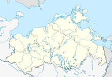
Location of the cadastral channel |
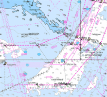
The Kadetrinne ( Danish : Kadetrenden ) is a sea area northeast of the Mecklenburg Bay of the Baltic Sea between the German peninsula Fischland-Darß-Zingst and the Danish island of Falster , i.e. northeast of Rostock . It is the most difficult and dangerous fairway in the Baltic Sea. Part of the Kadetrinne, which lies in the German exclusive economic zone , is designated as a nature reserve of around 100 square kilometers .
meaning
The Baltic Sea is very shallow between Mecklenburg and the Danish Islands, in large areas it is less than 20 meters deep. Ships with a great draft can only sail in certain deeper fairways here. An important one of these fairways is the Kadetrinne. The relatively steep-walled channel has a length of about 20 nautical miles and is 12 to 28 meters deep. Because of the Gedser Reef , among other things, the navigable area at the narrowest point (depending on the draft of the ship) is reduced to 500 to 1000 meters and at the same time requires a change of course of around 90 °. The lightship Gedser Rev marked this spot until 1972 .
The Kadetrinne is one of the busiest sea routes in Europe: in 2014 there were around 55,000 passages, 16% of which were tankers . In 2006 there were about 9000 tanker passages, about 5100 in the west and 3900 in the east. The number of transits increased sharply, which was explained in particular by the enlarged oil ports on the Gulf of Finland and the increased number of Russian oil tankers - their number had quadrupled between 1997 and 2006. The peak was reached in 2008 with 68,887 ship passages, at that time the share of tankers was still 11%. During the global economic crisis around 2009 , the number of ship passages decreased. In 2011 there were 58,672 and in 2014 54,492.
Efforts were made to increase the ship's safety in the Kadetrinne by requiring a pilot . In 2010, the state government of Schleswig-Holstein described them as “indispensable and probably the only means in the short term” to avoid ground contact. According to the Convention on the Law of the Sea, the Kadetrinne is located in international waters. The only body that could order a pilotage obligation here is the IMO . It does recommend the use of a pilot from a draft of 13 meters. However, it can only order a pilotage obligation if all neighboring states agree. The Russian government rejected them in 2010.
In 2013, three bombs found a few years earlier were recovered from the deck of a ship that sank during World War II and detonated in a controlled manner. A few years earlier they had been found in one of the most accident-prone locations and classified as dangerous.
A fixed Rostock-Gedser link that would span the Kadetrinne was proposed as an alternative to the fixed Fehmarnbelt link , but was rejected.
Military importance
In the Cold War in particular , the passage was of great military importance. Traditionally, the Soviet Navy operated from bases in the Baltic Sea, from which it wanted to advance into the North Sea in the event of war . The rearmament of Germany and Denmark effectively blocked this path, which forced the Soviet Union to build the Northern Fleet . One of the legacies of this situation is that German and Danish submarines are still being designed so that they can go submerged in 17 meters of water in order to pass the shallowest part of the Kadetrinne, which makes it almost unique in the world.
Accidents
- Willi Bänsch 1968
- Nikolaos P 2001
- Baltic Carrier 2001
- Johanna 2011
- Almeria 2013
- Maestro Diamond 2016
- Star of Sawara ( IMO number 9384930) 2017
Web links
Individual evidence
- ↑ a b Less traffic in Kadetrinne · The number of ships fell between 2011 and 2014 from 58,672 to 54,492 units . In: Daily port report of July 29, 2015, p. 2
- ↑ a b Answer of the state government of Schleswig-Holstein to a small inquiry from Heiner Garg "Tankerverkehr in der Ostsee". (PDF) Retrieved on July 11, 2010 (Landtag printed paper 16/1334).
- Jump up ↑ Two depth charges in the Baltic Sea. Hamburger Abendblatt , July 8, 2013, accessed on November 29, 2018 .
- ↑ Water bombs threaten shipping on the Baltic Sea. Süddeutsche Zeitung , June 4, 2008, accessed on July 11, 2010 .
- ↑ Damaged freighter: recovery started , NDR August 31, 2017, accessed on August 31, 2017
Coordinates: 54 ° 27 ′ 10 ″ N , 12 ° 11 ′ 41 ″ E


