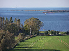
Mecklenburg Bay
The Mecklenburg Bay is part of the southwestern Baltic Sea and the largest German Baltic Sea bay. It is blurred by an imaginary line from the eastern tip of the island of Fehmarn ( Staberhuk ) in Schleswig-Holstein to the northern tip of the Darß peninsula ( Darßer Ort ) in Mecklenburg-Western Pomerania .
shipping
The Kadetrinne between Gedser on Falster and Warnemünde or Darßer Ort , an international shipping route ( Kiel-Ostsee-Weg and Lübeck-Gedser-Weg ) with extremely high ship traffic, is navigationally demanding and potentially dangerous also for the neighboring countries .
Geographical breakdown
The south-western and southern part of the approximately 3,500 km² bay is divided again: into the Lübeck Bay with the Neustädter Bay , the Boltenhagen Bay and the Wismar Bay . Some of the lagoon waters open to the Mecklenburg Bay ( Salzhaff , Pötenitzer Wiek , Zaufe ).
Islands
The island of Poel and the smaller islands of Walfisch and Langenwerder are located in the Mecklenburg Bay .
Seaports
The largest port cities on the Mecklenburg Bay are the Hanseatic cities of Lübeck , Wismar and Rostock .
More coastal and seaside resorts
Schleswig-Holstein
- Island and city of Fehmarn
- Grossenbrode
- Dahme
- Kellenhusen
- Groemitz
- Neustadt in Holstein with fur hooks
- Sierksdorf
- Scharbeutz
- Timmendorfer beach
- Lübeck - Travemünde with the Priwall east of the Trave
Mecklenburg-Western Pomerania

- Boltenhagen
- Rerik with the Wustrow peninsula
- Heiligendamm (district of Bad Doberan )
- Kühlungsborn
- Warnemünde (district of Rostock )
- Graal-Müritz
- Dierhagen
- Wustrow
- Ahrenshoop
- Darß
Lighthouses of the Mecklenburg Bay
literature
- Klein B. et al .: von Storch H., Meinke I., Claußen M. (eds): Hamburg Climate Report - Knowledge of Climate, Climate Change and Effects in Hamburg and Northern Germany . Ed .: Martin Claußen. Springer Spectrum, Berlin / Heidelberg 2018, German Bight with Tideelbe and Lübeck Bight, doi : 10.1007 / 978-3-662-55379-4_4 .
Coordinates: 54 ° 18 ' N , 11 ° 40' E

