Gemmersdorf
|
Gemmersdorf ( village ) locality cadastral community Gemmersdorf |
||
|---|---|---|
|
|
||
| Basic data | ||
| Pole. District , state | Wolfsberg (WO), Carinthia | |
| Judicial district | Wolfsberg | |
| Pole. local community | St. Andrä | |
| Coordinates | 46 ° 45 '27 " N , 14 ° 54' 8" E | |
| height | 567 m above sea level A. | |
| Residents of the village | 690 (January 1, 2020) | |
| Building status | 197 (2001) | |
| Area d. KG | 4.59 km² | |
| Statistical identification | ||
| Locality code | 02942 | |
| Cadastral parish number | 77206 | |
| Counting district / district | Eitweg-Ost (20913 010) | |
| Source: STAT : index of places ; BEV : GEONAM ; KAGIS | ||
Gemmersdorf is a village in Austria. The landmark of Gemmersdorf is the mill, which is located next to the fire brigade.
Gemmersdorf is located in the Wolfsberg district (Carinthia) and belongs to the municipality of St.Andrä.
Public facilities
- Gemmersdorf volunteer fire department
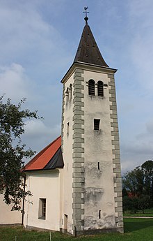
- Filialkirche Gemmersdorf (belongs to the parish Maria Rojach )
- Child friends Gemmersdorf


