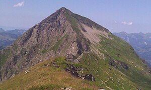
Giferspitz
| Giferspitz | ||
|---|---|---|
|
The Giferspitz from neighboring Lauenehore in the south |
||
| height | 2542 m above sea level M. | |
| location | Canton of Bern , Switzerland | |
| Mountains | Bernese Alps | |
| Dominance | 7.5 km → Niesehorn | |
| Notch height | 555 m ↓ Türli | |
| Coordinates | 593 450 / 144436 | |
|
|
||
| Normal way | Marked hiking trail | |
The Giferspitz is a 2542 m above sea level. M. high mountain near Gstaad in the Swiss canton of Bern , which belongs to the western Bernese Alps . Its summit is the highest point in the Saanen community and can be reached from Turbach in the north via a mountain hiking trail .
Location and surroundings
The Giferspitz is also the highest point between Gstaad and Lenk . Adjacent mountains are in the east, separated by the Turbachbach valley , the 2362 meter high Wistätthorn , in the course of the pronounced southern ridge of the Lauenehore at 2477 meters and in the east, separated by the Turnelsbachtal , the Wasserngrat (2191 meters). The next important place is Gstaad, which is about six kilometers as the crow flies to the north-west.
- National map of Switzerland 1: 25,000, sheet 1266, Lenk
Web links
- Giferspitz tour reports and photos

