
Saanen
| Saanen | |
|---|---|
 |
|
| State : |
|
| Canton : |
|
| Administrative district : | Obersimmental-Saanen |
| BFS no. : | 0843 |
| Postal code : | 1657 Abländschen 3777 Saanenmöser 3778 Schönried 3780 Gstaad 3781 Turbach 3783 Grund b. Gstaad 3792 Saanen |
| UN / LOCODE : | CH GST (Gstaad)
CH SAA (Saanen) |
| Coordinates : | 586794 / 148 016 |
| Height : | 1014 m above sea level M. |
| Height range : | 981-2541 m above sea level M. |
| Area : | 120.06 km² |
| Residents: | 6818 (December 31, 2018) |
| Population density : | 57 inhabitants per km² |
| Mayor : | Toni von Grünigen ( SVP ) |
| Website: | www.saanen.ch |
 Saanen, end of July 2012 |
|
| Location of the municipality | |
  |
|

Saanen ( French Gessenay ) is a political municipality and the main town in the Obersimmental-Saanen administrative district in the canton of Bern in Switzerland .
The localities ( called Bäuert ) belong to the municipality of Saanen: Saanen as the main and administrative center, Abländschen , Bissen, Ebnit, Gruben , Grund, Gstaad , Kalberhöni, Saanenmöser , Schönried and Turbach .
geography
To the south of Saanen are the communities of Gsteig (borders on the canton of Valais and is more south than Airolo ) and Lauenen . Saanen itself borders in the west and north on the cantons of Vaud and Friborg , and in the east on the Simmental communities of Boltigen , Zweisimmen , St. Stephan and Lenk . The highest point is the 2,542 meter high Giferhorn, the deepest point is 985 meters on the Saane near the Rüttischlucht.
Saanen village
The main town of Saanen is the village of the same name, Saanen. It is 3 km away from Gstaad and directly borders the canton of Vaud. The Vanel mountain between Saanen and Rougemont forms the canton and language border.
The name of the place comes from the largest river of the same name in the area, the Saane . Around the 5th century the Burgundians immigrated, and in the 8th century Alemanni, who immigrated from the Simmental, brought the German language into the Saanen valley. Politically, Saanen belonged to the county of Ogo, first mentioned around 900, later called Gruyère.
The Mauritius Church is also in Saanen, where Yehudi Menuhin founded his annual concerts in the Saanen Church. It almost burned down at the beginning of the 20th century, but it could be saved. Then it was rebuilt and renovated.
In 1911 a severe mouse plague came over Saanen . To this day (as of September 2017), citizens receive a certain amount of money for each mouse shot. Every year, four employees of the municipal administration are busy counting the mouse tails submitted by the citizens and paying out the corresponding proceeds.
With the new bypass road, opened in 2010, the village image will be adapted to the original. Many beautiful old houses adorn the picture. The community-owned Hotel Landhaus from the 19th century and the hundred-year-old Hotel Saanerhof are striking buildings in the center of Saanen.
Saanen houses the Menuhin Center .
Saanenland
The Saanenland was until 2009 Bernese District with the three municipalities Saanen, Gsteig and Lauenen (see also District Saanen ).
history
A fortified hilltop settlement probably from the Bronze Age existed on the Cholis Grind. Saanen was 1,228 as Gissinay mentioned in 1340 as Sanon and French Gessenay . The Schwabenried tower had existed since around the year 1000, and the Kramburg, which was expanded in 1331, was located on the mule paths into Valais and Vaud. The village was the center of the area of the same name and the large parish. The Mauritius Church was first mentioned in 1228, expanded from 1444 to 1447, and wall paintings date from the second half of the 15th century. There was also the Anna Chapel, built in 1511, as well as the Johannes Chapel and the Infirmary Chapel. Five to six priests with church lords and chaplains had to look after the population. From this parish resp. The parish of Gsteig broke up after 1500, Lauenen in 1522 and Abländschen in 1704. The church set was handed over to the Rougemont priory in 1330 by the Counts of Gruyères, and with the Reformation in 1556 it fell to Bern. In 1575 the village burned down.
Apart from the street villages Saanen and Gstaad, the eleven farmers were scattered settlements. Sources of income were framing, livestock and forestry. There were handicrafts and trades in Saanen, and weekly and annual markets were also held. Guest houses were the two taverns, the small and the large country house, and a sust from the 14th century, which today forms the core of the rectory.
In 1833 an independent political municipality was created. In 1845 the first road with a postbus course to Zweisimmen was completed. In 1867 a secondary school was established, which is now located in the upper school center Ebnit and is one of 11 school buildings. In 1874 the Spar- und Leihkasse was opened, which has been called Saanen Bank since 1980. After the opening of the Montreux-Oberland Railway in 1905, tourism increased significantly. The district hospital has also existed since 1905 and is now part of Spital STS AG. The commercial vocational school has existed since 1908; today it is the Saanenland-Obersimmental business school, which is part of the Thun business school. The home weaving with the central sales point of the Heimatwerk was an important line of business between the world wars. Many holiday homes were built after 1945, which encouraged employment in the local construction industry. Bergbahnen Destination Gstaad AG, which operates more than 60 lifts in the region, is an important economic factor today. A local museum opened its doors in 1999.
Names
The German name Saanen, originally probably Sanona , is derived from the Swiss Alpine river Saane . The French name Gessenay has been attested since 1228, initially as Gissinai. This document is even older than the first German-language document Saanen . There are different interpretations, for example derivatives of personal names ( Gissi , Getti or similar) in connection with Latin endings for field names ( -acum and -etum ). Other derivatives assume a Latinization of Wyssenöye (literally Weisungsaue and will be voted on on political instructions meadow ). Folk etymological interpretations also go back to Wyssenöye , but in the interpretation weisse Wiese , but the derivation of a local field name Giessen is also mentioned.
population
| Population development | |||||||
|---|---|---|---|---|---|---|---|
| year | 1764 | 1850 | 1900 | 1950 | 2000 | 2016 | 2018 |
| Residents | 2939 | 3629 | 3690 | 4899 | 6914 | 6882 | 7643 |
politics
The voting shares of the parties at the 2015 National Council election were: SVP 52.8%, FDP 14.4%, BDP 10.5%, SP 5.3%, glp 5.2%, EDU 3.2%, GPS 2.9 %, EVP 2.9%, CVP 0.8%.
Healthcare
Saanen had a public hospital until November 2012 . Health care was reorganized with the intention of optimizing costs. After the closure, the population will be supplied by local service providers to be expanded (family doctors and group practices) and the Zweisimmen and Thun hospitals of the STS hospital network (Spital Thun Simmental).
traffic
Saanen has a train station on the Montreux – Lenk railway in the Simmental , which is served by the Montreux-Bernese Oberland Railway . Scenes from First Come Get the Bride , one of the most successful Bollywood films, were filmed at this station .
Saanen owns the Saanen airfield , which is used for a variety of aviation activities.
photos

St. Mauritius

Rectory
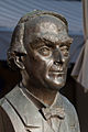
Bust of Yehudi Menuhin

Office building

Village center

Typical house


Attractions
- Museum of the Saanen Landscape
Sports
Abländschen is the starting point for the participants of the short route in the annual Trophée des Gastlosen , a popular and competitive race in the field of ski mountaineering .
Town twinning
Personalities
- Hans Raaflaub (1928-2010), writer
- Julie Andrews (* 1935), honorary citizen of Saanen
- Johannes Bach (1808–1866), judge and politician
- Philippe Bach (* 1974), conductor
- Walter Gander (* 1944), mathematician and computer scientist, university professor
- Reto Knutti (* 1973), climatologist and university professor
- Christian Kracht (* 1966), writer
- Yehudi Menuhin (1916–1999), honorary citizen of Saanen
- Andreas Matti (* 1959), actor
- Rudolf Schatzmann (1822–1886), pastor, farmer and agricultural functionary
- Isabelle von Siebenthal (* 1957), actress and dancer
- Steffi von Siebenthal (* 1977), snowboard world champion
- Karl Uelliger (1914–1993), painter, draftsman and sculptor
literature
- Collection of Swiss Legal Sources, Section II: The Legal Sources of the Canton of Bern, Part Two: Rights of the Landscape, Volume 3: The statutory law of the Saanen landscape until 1798 by Hermann Rennefahrt, Aarau 1942. ( Online version )
- Swiss Lexicon. 7 volumes, Encyclios, Zurich 1945–1948, volume 6, p. 736.
Web links
- Official website of the municipality of Saanen
- Anne-Marie Dubler : Saanen (community). In: Historical Lexicon of Switzerland .
Individual evidence
- ↑ Permanent resident population from STAT-TAB of the BfS , municipalities see also regional portraits 2020 on bfs.admin.ch, accessed on May 29, 2020
- ^ Anne-Marie Dubler : Saanen (community). In: Historical Lexicon of Switzerland .
- ^ Johann Jakob Egli : Nomina geographica. Language and factual explanation of 42,000 geographical names of all regions of the world. Friedrich Brandstetter, 2nd ed. Leipzig 1893, p. 799 ( Saane ).
- ↑ Results of the Saanen community. State Chancellery of the Canton of Bern, October 18, 2015, accessed on October 30, 2016 .
- ^ Museum of the Saanen Landscape. Retrieved May 13, 2020 .
- ↑ Switzerland currently from June 5, 2014 on SRF 1