
Lauenen
| Lauenen | |
|---|---|
 |
|
| State : |
|
| Canton : |
|
| Administrative district : | Obersimmental-Saanen |
| BFS no. : | 0842 |
| Postal code : | 3782 |
| Coordinates : | 590 622 / 140598 |
| Height : | 1252 m above sea level M. |
| Height range : | 1144-3247 m above sea level M. |
| Area : | 58.49 km² |
| Residents: | 827 (December 31, 2018) |
| Population density : | 14 inhabitants per km² |
| Website: | www.lauenen.ch |
 Church and village center of Lauenen |
|
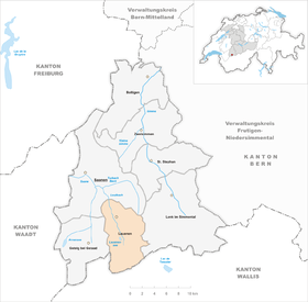
| Location of the municipality | |
  |
|
Lauenen ( French Lauvine ) is a municipality in the Obersimmental-Saanen administrative district in the canton of Bern in Switzerland .
Besides the resident community there is no civic community. There is also a parish of the Reformed Churches Bern-Jura-Solothurn .
Surname
Lauenen (Romanesque lavina ) is known as a place with landslides and a high risk of avalanches. Lauenen is first mentioned historically in 1296 as on the lowinon .


geography
Lauenen is located in the Bernese Oberland in the Lauenen Valley. The neighboring communities starting from the north in a clockwise direction are Saanen , Lenk , Ayent , Savièse and Gsteig near Gstaad .
The mountains in the south of the municipality, z. B. the Wildhorn ( 3248 m above sea level. M. ), form the border to Valais . The lowest point of the community is at 1153 m above sea level. M. (Engewald) in a southerly direction, the Wildhorn is the highest peak.
The Tungel Glacier , the Gelten Glacier and the Lauenen Lake are located in Lauenen .
Of the total area of 58.71 km² (29.59 km²), more than half is agricultural land, 12.77 km² is forest and only 0.23 km² is settlement area.
politics
The voting shares of the parties at the 2015 National Council election were: SVP 67.0%, BDP 7.1%, FDP 6.2%, SP 5.7%, EDU 5.2%, GPS 2.7%, EVP 2.2 %, glp 2.0%, CVP 1.1%.
Partner municipality
Personalities
- Julius Stadler (1828–1904), Swiss architect and university professor, died in Lauenen
- Ernst Friedrich Langhans (1829–1880) worked from 1855 to 1858 in Lauenen as a Reformed pastor
- Gottfried Strasser (1854–1912), pastor and poet (born in Lauenen)
- Bertha Züriche r (1869–1949), painter and writer often stayed in Lauenen.
Attractions
Web links
- Official website of the municipality of Lauenen
- Anne-Marie Dubler : Lauenen. In: Historical Lexicon of Switzerland .
- Lauenen in: Geographical Lexicon of Switzerland (1902)
Individual evidence
- ↑ Permanent resident population from STAT-TAB of the BfS , municipalities see also regional portraits 2020 on bfs.admin.ch, accessed on May 29, 2020
- ↑ [1]
- ↑ Results of the community of Lauenen. State Chancellery of the Canton of Bern, October 18, 2015, accessed on October 30, 2016 .
- ↑ Partner municipality Babylon (CZ) on www.lauenen.ch. In: www.lauenen.ch. Retrieved August 9, 2016 .