
Gsteig near Gstaad
| Gsteig near Gstaad | |
|---|---|
 |
|
| State : |
|
| Canton : |
|
| Administrative district : | Obersimmental-Saanen |
| BFS no. : | 0841 |
| Postal code : | 3785 |
| Coordinates : | 586 770 / 136900 |
| Height : | 1184 m above sea level M. |
| Height range : | 1101–3120 m above sea level M. |
| Area : | 62.40 km² |
| Residents: | 978 (December 31, 2018) |
| Population density : | 16 inhabitants per km² |
| Mayor : | Markus Willen |
| Website: | www.gsteig.ch |
 The church of Gsteig |
|
| Location of the municipality | |
  |
|
Gsteig bei Gstaad ( French Châtelet ) is a municipality in the Obersimmental-Saanen administrative district in the canton of Bern in Switzerland .
Gsteig is a community of residents without a civic community . There is also an Evangelical Reformed parish .
Surname
Gsteig goes back to the old high German steiga (ascent) and describes the point where the old path connection to the Col du Pillon rises. The name chastellet comes from the old French "chastel" - name for castle, fortress or summit.
geography
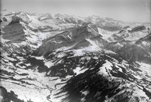
Gsteig bei Gstaad is located in the Bernese Oberland on the way to the Col du Pillon . The community consists of the places Gsteig and Feutersoey . The neighboring municipalities starting from the north and clockwise are Saanen , Lauenen , Savièse , Ormont-Dessus and Château-d'Oex . The mountains in the south of the municipality form the border with Valais . In the district of Feutersoey there is the Arnensee , a reservoir.
history
The place was first mentioned in 1312 with the name Chastelet , from 1453 it was called Steig and in French Châtelet . At that time, the Theodulskirche was consecrated, which was a branch of Saanen until it became a church independent. In 1458 a castle was mentioned, of which only remains of the wall are left today. A settlement called Ussers Gründ was destroyed by a landslide at an unknown time. The Reformation was introduced in 1556 under the rule of Bern.
In Gsteig there has been an alpine economy for centuries, there has been a cattle market since 1727. As a sideline, wood processing developed first and from 1900 some tourism with hotels and holiday homes, which is oriented towards Saanen and the Diablerets Glacier , where people also ski in summer. Other local excursion destinations are the Castle Falls, the Arnensee and the nature reserve on the Oldenhorn. Today, the locals mainly work in Gstaad.
politics
The voting shares of the parties on the occasion of the 2015 National Council election were: SVP 61.1%, BDP 11.0%, SP 6.9%, FDP 5.8%, glp 5.3%, GPS 3.4%, Alpine Parliament 2.3 %, EVP 1.8%.
Markus Willen has been the mayor since 2013.
Attractions
Personalities
- Friedrich Gerber (1828–1905), Protestant clergyman and educator
- Johann Peter Romang (1802–1875), Protestant clergyman, theologian and university professor
- Johann Jakob Romang (1831–1884), writer
Web links
- Official website of the community of Gsteig bei Gstaad
- Anne-Marie Dubler : Gsteig. In: Historical Lexicon of Switzerland .
Individual evidence
- ↑ Permanent resident population from STAT-TAB of the BfS , municipalities see also regional portraits 2020 on bfs.admin.ch, accessed on May 29, 2020
- ^ Anne-Marie Dubler : Gsteig. In: Historical Lexicon of Switzerland .
- ↑ Results of the community of Gsteig. State Chancellery of the Canton of Bern, October 18, 2015, accessed on October 30, 2016 .