Gleißach
|
Gleißach Gleißenbach |
||
|
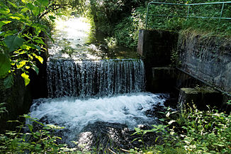
Gleißach at the "Am Hierlbach" settlement in Johanneskirchen |
||
| Data | ||
| Water code | DE : 163314 | |
| location | Munich and District of Munich , Bavaria , Germany | |
| River system | Danube | |
| Drain over | Seebach → Isar → Danube → Black Sea | |
| source |
Johanneskirchener Moos 48 ° 10 ′ 23 ″ N , 11 ° 39 ′ 53 ″ E |
|
| muzzle | north of the Middle Isar Canal in the Seebach Coordinates: 48 ° 12 ′ 18 ″ N , 11 ° 41 ′ 8 ″ E 48 ° 12 ′ 18 ″ N , 11 ° 41 ′ 8 ″ E
|
|
| length | 5.4 km including underpasses at Teichgut Birkenhof | |
| Left tributaries | Hirlgraben | |
| Big cities | Munich | |
| Communities | Unterföhring | |
|
Gleißach at Feringasee in Unterföhring |
||
|
Entry of the Gleißach into the culvert under the supply channel of the Birkenhof pond |
||
The Gleißach , also called Gleißenbach , is a flowing water in the city of Munich and the district of Munich and belongs to the river system of the Isar .
Today's course
The source of the Gleißach is in the Johanneskirchener Moos near Apenrader Straße. The stream runs essentially to the north and flows past the Feringasee to the west . At Teichgut Birkenhof it bends to the west and runs for about 1 km parallel to the canal that supplies the fishponds of the Teichgut with water. Then it is led through a culvert under this canal and the Mittlere-Isar-Kanal , where it merges into the Seebach .
The Gleißach forms a continuous river with the Seebach and is also listed in the map service water management of the Bavarian State Office for the Environment under the name "Seebach" as a uniform river. However, there, too, the two sections, i.e. Gleißach and Seebach, are distinguished from one another by different colors and provided with different waterway indicators.
The only named tributary to the Gleißach is the approximately 1.6 km long Hirlgraben, also written Hierlgraben, which begins in the center of Johanneskirchen and flows into the Gleißach at the Am Hierlbach settlement .
Historical course
Today's Gleißach originally formed the upper reaches of the Gleißenbach. This originally ran further north from today's bend in the Gleißach and flows into the Seebach in Ismaning.
When the Middle Isar Canal was built, the Gleißach was not passed under the canal in its original location and continued in its old bed, but was only directed about 1 km further west and fed into the Seebach. This had lost its source streams due to the construction of the interception ditch built at the same time as the Middle Isar Canal . However, since it was used to drive the Ismaning mills and an electricity station, the required water was now supplied via the Gleißach.
Most of the original lower reaches of the Gleißenbach north of the Mittlere-Isar-Kanal lies dry today. Only from the Ismaning Citizens' Park does the creek bed lead again and flows into the Seebach in the Ismaning town center.
Web links
Individual evidence
- ↑ Map service for water management of the Bavarian State Office for the Environment (LfU)
- ^ Course of the Gleißenbach on the historical map in the BayernAtlas


