Seebach (Isar)
| Seebach | ||
|
Seebach in Ismaning |
||
| Data | ||
| Water code | DE : 163314 | |
| location | at Ismaning ; District of Munich , Upper Bavaria ( Germany ) | |
| River system | Danube | |
| Drain over | Isar → Danube → Black Sea | |
| source | near Ismaninger reservoir on the Middle Isar Canal 48 ° 12 ′ 17 ″ N , 11 ° 41 ′ 11 ″ E |
|
| Source height | approx. 495 m above sea level NHN | |
| muzzle | at Ismaning in the Isar Coordinates: 48 ° 14 ′ 1 ″ N , 11 ° 40 ′ 14 ″ E 48 ° 14 ′ 1 ″ N , 11 ° 40 ′ 14 ″ E |
|
| Mouth height | approx. 481 m above sea level NHN | |
| Height difference | approx. 14 m | |
| Bottom slope | approx. 4 ‰ | |
| length | 3.5 km | |
| Left tributaries | Gleißenbach | |
| Right tributaries | Kernbach | |
| Communities | Ismaning | |
|
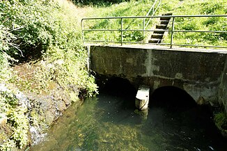
Beginning of the Seebach near the culvert end of the Gleißach |
||
|
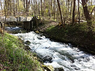
Seebach at the confluence with the Isar |
||
The Seebach is a 3.5 km long flowing water in the municipality of Ismaning in the Bavarian district of Munich . It connects the Middle Isar Canal with the Isar .
Today's course
The Seebach begins west of the Ismaninger reservoir . It receives part of its water from the Gleißach , which is led through a culvert under the Mittlere-Isar Canal at the level of the Birkenhof pond . More water comes from a moat to which water is supplied from the Mittlere-Isar-Kanal. The stream will initially continue underground and will come to light again after 20 m north of the path that runs parallel to the Mittlere-Isar-Kanal.
After a distance of around 3.5 kilometers, in parts as a local stream through the center of Ismaning, the Seebach flows into the Isar at river kilometer 134.2 . Apart from Gleißenbach and Kernbach , the Seebach no longer has any named natural tributaries.
Historical course
Until the construction of the Middle Isar Canal from 1921, the Seebach was around nine kilometers long and originated in the Johanneskirchener Moos between Johanneskirchen and Aschheim . With the lowering of the groundwater level during the construction of the canal and reservoir, it lost its upper reaches, which were described in detail by Anton Eisenmann and Karl Friedrich Hohn in their Topo-Geographical-Statistical Lexicon of the Kingdom of Bavaria in 1832 :
"Seebach, brook in the Ldg. Erding and Munich, which in the Erdinger Moose through the confluence of the Breitenbach brook from Riem, then the upper ditches, the bird ditch, the upper and lower Dornach brooks, the long ditches, the Haressel brooks, the Fahrtbächels, the Aschheimerbach brooks, the Müller brooks and Föhringerbaches, Mühlbaches, Schwarzbrunnens, old trenches, Neugrabenes, large and small Erlbaches, Körngraben and Koppenbachels, in Ismaning the Gleisachbächel takes up and falls below Ismaning into the Isar. "
According to a description from 1936, the construction of the canal had a significant impact on the Seebach:
“In the Seebach area, the upper ditch, the Dornachbach, Dornacher Grenzgraben, Dornacher Dorfgraben, Habröselbach and Aschheimer Mühlbach, which together form the Mühlbach (after its union with the Föhringer Bach it is called Seebach), were cut off by the interception ditch and entered. A number of other streams, such as Gleissach, Humpelgraben, Großer Erlbach, Kleiner Erlbach, Fahrbach, are narrowed in their water flow. As a result, the upper part of the Seebach, the course of which is interrupted by the works channel and the fish ponds, is drained. Its lower course also shows a noticeable decrease in the amount of water. In order to be able to maintain the operation of the mills located on this stream, water had to be slipped over from the works canal at times. "
To compensate for the missing source streams, the Seebach is now fed by the Gleißach.
Economic use
In Ismaning, the Seebach was used by two mills (see list of monuments in Ismaning ) and to supply a paper mill with water. In addition, 33 Ismaning citizens founded a "Consortium for the establishment of an electrical central station" in 1898 for the construction and operation of a hydropower plant on the Seebach. The plant received a turbine with an output of 60 hp . After the local use of hydropower had come to an end in the meantime , a turbine with an output of 31 kilowatts was installed again in 2008 in the Seidl mill, which has now been converted into a communal cultural center .
literature
Cornelia Oelwein: Between Goldach and Seebach. The history of the Goldachhof and moss cultivation in Ismaning. Contributions to the history of Ismaning Vol. 2. Franz Schiermeier Verlag Munich 2013. ISBN 978-3-943866-22-3 .
Web links
Individual evidence
- ↑ a b Map services of the Federal Agency for Nature Conservation ( information )
- ↑ Source streams of the Seebach , on a historical map in the BayernAtlas, on geoportal.bayern.de
- ^ Joseph Anton Eisenman, Karl Friedrich Hohn: Topo-geographical-statistical lexicon of the Kingdom of Bavaria. Palm / Enke publishing house, Erlangen 1832
- ↑ Käthe Heindel: The transformation of the Isar by man. (= Dissertation, Munich 1936) M. Müller & Sohn, Munich 1936, OCLC 223970323 , p. 98.
- ↑ Power grid. Archived from the original on January 16, 2012 ; Retrieved April 22, 2016 . , on gwi.ismaning.de
- ↑ DOCUMENTATION. Retrieved April 22, 2016 . , on seil-muehle.ismaning.de
- ↑ References. Archived from the original on July 19, 2013 ; Retrieved April 22, 2016 . , on watec-hydro.de


