Glonn (Mangfall)
| Glonn | ||
|
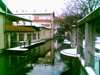
The Glonn in the urban area of Bad Aibling |
||
| Data | ||
| Water code | EN : 1826 | |
| location | Upper Bavaria , Bavaria, Germany | |
| River system | Danube | |
| Drain over | Mangfall → Inn → Danube → Black Sea | |
| source | near Glonn (district of Ebersberg) 47 ° 59 ′ 34 ″ N , 11 ° 51 ′ 27 ″ E |
|
| Source height | 550 m | |
| muzzle | near Bad Aibling in the Mangfall coordinates: 47 ° 51 '13 " N , 12 ° 1' 1" E 47 ° 51 '13 " N , 12 ° 1' 1" E |
|
| Mouth height | 472 m | |
| Height difference | 78 m | |
| Bottom slope | 2.7 ‰ | |
| length | 28.7 km | |
| Catchment area | 144.57 km² | |
| Discharge at the Bad Aibling A Eo gauge : 149 km² Location: 1.2 km above the mouth |
NNQ (05.10.1964) MNQ 1928–2006 MQ 1928–2006 Mq 1928–2006 MHQ 1928–2006 HHQ (31.05.1940) |
460 l / s 1.44 m³ / s 3.12 m³ / s 20.9 l / (s km²) 27.4 m³ / s 64.1 m³ / s |
| Left tributaries | Braunau , Dambach | |
| Right tributaries | Kupferbach , Moosbach | |
| Small towns | Bad Aibling | |
| Communities | Glonn , Baiern , Feldkirchen-Westerham , Bruckmühl , Tuntenhausen | |
The Glonn ( Celtic : Glana - "the clear") is a river in Upper Bavaria . It rises at its source near Glonn in the district of Ebersberg and flows southeast via Beyharting (municipality of Tuntenhausen ) to Bad Aibling , where it flows into the Mangfall . The Glonn is about 26 km long.
Web links
Commons : Glonn - collection of images
Individual evidence
- ↑ a b List of waters Inn
- ^ German Hydrological Yearbook Danube Region 2006 Bavarian State Office for the Environment, p. 239, accessed on October 4, 2017, from: bestellen.bayern.de (PDF, German, 24.2 MB).
