Goldbach (Beavers)
| Goldbach | ||
|
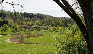
The Goldbach shortly after the outflow from the Rößlesmahdsee |
||
| Data | ||
| Water code | DE : 23865412 | |
| location |
Swabian-Franconian forest mountains
|
|
| River system | Rhine | |
| Drain over | Bibers → Kocher → Neckar → Rhine → North Sea | |
| source | Flows from the Rößlesmahdsee about 0.4 km northeast of Waldenburg -Goldbach. 49 ° 10 ′ 21 ″ N , 9 ° 39 ′ 37 ″ E |
|
| Source height | 455 m above sea level NHN | |
| muzzle | near Waldenburg-Neumühle from the right in the Neumühlsee, through which the Upper Beaver flows, coordinates: 49 ° 9 '55 " N , 9 ° 38' 49" E 49 ° 9 '55 " N , 9 ° 38' 49" E |
|
| Mouth height | 433.1 m above sea level NHN | |
| Height difference | 21.9 m | |
| Bottom slope | 13 ‰ | |
| length | 1.6 km from the outlet of the Rößlesmahdsee to the middle of the Neumühlsee |
|
| Catchment area | 1.991 km² | |
| Reservoirs flowed through | Rößlesmahdsee , Goldbachsee , Neumühlsee | |
|
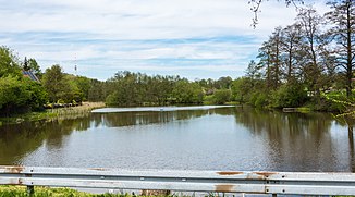
The Goldbachsee |
||
The Goldbach is a stream in the area of the small town of Waldenburg in Hohenlohekreis in northern Baden-Württemberg, 1.6 km long, which flows into the Neumühlsee from the left at the Neumühle von Waldenburg residential area, through which the Beaver flows.
geography
Source and history
The Goldbach is the outflow of the Rößlesmahdsee about 400 m northeast of Waldenburg-Goldbach. He drains the 1.9 hectare, at 455 m above sea level. NHN lying lake to the south and immediately goes into a slow curve to the west. After about 0.3 km it flows into the 1.6 hectare Goldbachsee , which is immediately adjacent to the west of the hamlet of Waldenburg-Goldbach, formerly the site of the monastery of the same name . He leaves the at 449.3 m above sea level. NHN lying lake in a south-westerly direction and flows about a kilometer further into the east bay of the Neumühlsee, which occupies an area of 5.7 hectares and from its main tributary Bibers to 433.1 m above sea level. NHN is traversed from north to south.
The Goldbach has a length of 1.6 km from the outlet of the Rößlesmahdsee to the middle of the Neumühlsee and on this route falls by about 22 meters in altitude, this corresponds to a bed gradient of about 13 ‰.
Catchment area
The catchment area of the Goldbach lies on the eastern edge of the Waldenburg Mountains , in natural terms a northern sub-region of the Swabian-Franconian Forest Mountains . It occupies an area of 2.0 km² and extends to the plateaus of Buchberg (up to approx. 503 m above sea level ) in the north-west, Friedrichsberg (up to approx. 510 m above sea level ) in the north, Mühlberg (up to approx . 520 m above sea level. NHN ) in the southeast and Lauracher level (un approximately 490 NHN m above sea level. ) in the south. All these mountains are - with the exception of the plateau of the Laurach plain - at least forested from the middle slopes upwards. Its north-eastern edge is a very narrow threshold that rises less than two meters above the level of the Rößlesmahdsee, at the edge of which the terrain in the Pfaffenklinge slopes steeply to the lower area of the Kupferzeller Ebene and Kocheneck of the Hohenloher and Haller levels .
In the north on the Friedrichsberg the catchment area of the Epbach flowing to the Ohrn borders briefly , in the east that of the Beltersroter Bach , which drains over the Kupfer , and its right tributary from the Eselsklinge . In the south, again only for a short stretch on the Laurach plain , the competitor is the Altenhaubächle , which flows further down to the Bibers . In the whole west, the water flows in the southwest partially over a slope brook that is emerging in a marsh area south of the Höhenweiler Waldenburg-Laurach, in the central area over the Neumühlsee, otherwise everywhere directly to the Bibers , the uppermost of the three small rivers Bibers that all drain to the Kocher , Copper and finally Ohrn is.
Since the residential area Neumühle am Neumühlsee and Laurach in the south on the Laurach plain are just outside the catchment area limits, the hamlet of Goldbach am Bachlauf is the only settlement area in it. The eastern part of the campsite at Neumühlsee belongs to the valley, and a large part of the bathing operations on the southeastern bank of the Neumühlsee are still in the area of the Goldbach valley. The whole area lies in the central part of the small town of Waldenburg .
Landscape, traffic and protected areas
The valley of the short Goldbach is a comparatively wide, in its flat areas agriculturally used hollow in which the grassland predominates. On the lower slope of the valley, which moves closer to the stream in the lower valley, the forest begins on both sides and covers most of the entire catchment area. Due to the rather quiet valley, coming from Beltersrot in the northeast of the Hohenlohe Plain, the K 2363, except on weekends and in summer, when there is bathing at Neumühlsee. It rises on the southwest edge of the Pfaffenklinge , partly accompanied by sandstone rocks on the slope side almost 400 m climbing route by almost 60 m high to the Goldbachtal. In Goldbach, another public road from Waldenburg in the north-north-west meets them. Two small climbing paths from Goldbach and Neumühlsee to Laurach on the plateau to the left above the valley are closed to general traffic.
The Goldbach flows through a reed zone into the Goldbachsee. After this, accompanied on one side by a patchy tree gallery and on the other by a farm road, it runs in a conspicuously smooth, twistless route to the reed zone in front of its mouth on the Neumühlsee.
The Rößlesmahdsee and its surroundings are part of a nature reserve that extends eastward across the catchment area border into the Pfaffenklinge. Most of the valley floor is located in a nature reserve. A water protection area extends from the Friedrichsberg down in the upper valley area to the edge of the Rößlesmahdsee and the hamlet of Goldbach. The entire area lies in the Swabian-Franconian Forest Nature Park .
geology
The creek and valley basin lie entirely in the reed sandstone ( Stuttgart Formation ), the slopes on both sides rise over the Lower Colorful Marl ( Steigerwald Formation ) to the plateaus in the silica sandstone ( Hassberge Formation ). The Beltersroter Bach , which flows northeast of the Rößlesmahdsee (see also there) in the steeply sloping Pfaffenklinge , gnaws heavily at the catchment area of the Goldbach, which flows with only about 13 ‰ mean bottom slope to the southwest, it soon reaches the Gipskeuper ( grave field formation ) and has here created a geotope that is informative for the river history of the region.
Sights and buildings
- Nature reserve Rößlesmahdsee with Pfaffenklinge , in the side valley of the Goldbach , north of the K 2363 just before the extremely steep climb down to Beltersrot. The valley of the Goldbach, tributary of the Danubian beavers, is brutally tapped in the blade by a side stream of the Rhenish copper by erosion from above.
- In today's hamlet, remains of the former Cistercian monastery Goldbach next to the Goldbachsee , approx. 1 km east of the Neumühlsee on the K 2363.
Individual evidence
LUBW
Official online waterway map with a suitable section and the layers used here: Course and catchment area of the Goldbach
General introduction without default settings and layers: State Institute for the Environment Baden-Württemberg (LUBW) ( notes )
- ↑ a b c Height according to the blue lettering on the background layer of the topographic map .
- ↑ Length according to the waterway network layer ( AWGN ) .
- ↑ Catchment area according to the basic catchment area layer (AWGN) .
- ↑ a b c Lake area according to the layer standing waters .
- ↑ a b c d Height according to the contour line image on the background layer topographic map .
- ↑ Protected areas according to the relevant layers, nature partly according to the biotope layer .
- ↑ Geotope according to the relevant layer.
Other evidence
- ↑ Wolf-Dieter Sick : Geographical land survey: The natural space units on sheet 162 Rothenburg o. D. Deaf. Federal Institute for Regional Studies, Bad Godesberg 1962. → Online map (PDF; 4.7 MB)
- ↑ Geology according to the layers for Geological Map 1: 50,000 on: Map server of the State Office for Geology, Raw Materials and Mining (LGRB) ( notes ). The geological map listed under → Literature offers a similar picture .
- ↑ Official protection ordinance for the nature reserve "Rößlesmahdsee mit Pfaffenklinge"
literature
- Topographic map 1: 25,000 Baden-Württemberg North, as single sheet No. 6823 Pfedelbach and No. 6824 Schwäbisch Hall
- Geological map of the Swabian-Franconian Forest Nature Park 1: 50,000, published by the State Office for Geology, Raw Materials and Mining Baden-Württemberg, Freiburg i. Br. 2001
Web links
- Map of the course and catchment area of the Goldbach on: State Institute for the Environment Baden-Württemberg (LUBW) ( information )
- Map of the course and catchment area of the Goldbach on: Geoportal Baden-Württemberg ( information )
- Measuring table sheets in the Deutsche Fotothek :
- 6823 Pfedelbach from 1932
- 6824 Hall from 1930

