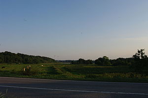
Goossee
| Goossee | ||
|---|---|---|

|
||
| The silting areas and the Goossee. | ||
| Geographical location | District of Rendsburg-Eckernförde , Schleswig-Holstein | |
| Drain | in the Eckernförde Bay | |
| Location close to the shore | Eckernförde | |
| Data | ||
| Coordinates | 54 ° 26 '29 " N , 9 ° 51' 20" E | |
|
|
||
| Depth below sea level | 0.7 m below sea level | |
| surface | 11.4 ha | |
| scope | 2.19 km | |
The Goossee ( Low German , Danish : Goos Sø , Gås Sø , High German translation would be: Gänsesee ) is an inland body of water between the Eckernförde Bay and the communities of Goosefeld , Altenhof and Eckernförde in Schleswig-Holstein .
Surname
The name is probably derived from the Low German ( Goos ) and Danish ( Gås , spoken Gooss) designation for geese .
location
The existing water surface of the heavily silted lake is shared by the communities of Altenhof and Goosefeld, part of the silted area belongs to Eckernförde. The lake originally connected to the Baltic Sea is separated from the Baltic Sea by a dam on the B 76 between the Sandkrug district of Eckernförde and the Kiekut district of Altenhof , but connected to it by an outlet. Water is pumped out of the lake, so that its water level by 0.7 meters below sea level below that of the sea is.
The Goossee has been under special protection since the 1980s. It lies in the protected landscape coastal landscape Danish Wohld .
history
The Goossee was created during the Vistula Ice Age: The large Baltic Sea glacier from the Vistula Ice Age divided into a “Holstein Lobus ” and a “Eckernförde Lobus” in Schleswig-Holstein ; the "Eckernförde Lobus", in turn, was divided into a northern (" Windebyer Noor tongue") and a southern one (" Wittensee -Goossee- ") in what is now the Eckernförde area, taking advantage of a contour line of the Eckernförde Bay that was created before the Ice Age. Tongue ") partial ice tongue. The northern tongue formed u. a. the Hüttener Berge , the Wittensee-Goossee-Tunge the Duvenstedter Berge. The Goossee lowland is - like the Windebyer Noor - a still existing ice tongue basin from the Vistula Ice Age; Former cliffs can be found both on the Eckernförder and on the Altenhofer side of the water. 5000 years ago the area of the lake was 150 hectares, in 1877 it was 50 hectares.
In the 17th to 19th centuries (until 1873) a canal connected the Goossee with the Eckernförde Bay at the level of today's round pavilion on the Baltic Sea beach and thus more northerly than today's outlet. It was used as a barge connection from the loading point at Goossee to transport bricks and lime from the brickworks that existed there at that time ( Windebyer brickworks ) and a lime distillery to the city port of Eckernfördes.
If the Morgenthau Plan had been implemented, the Goossee and its outlet into the Baltic Sea would have become the state border between Denmark and the Kaiser Wilhelm Canal International Zone after the Second World War .
literature
- Helmut Jöhnk and Michael Packschies: Nature conservation in the Eckernförde Goossee-Wiesen online
Web links
- History of the Goossees (PDF file; 891 kB)
Individual evidence
- ↑ a b Goossee: Characteristic data . In: Ministry for Energy Transition, Agriculture, Environment and Rural Areas Schleswig-Holstein: Lakes (accessed on September 16, 2012)
- ↑ Guorun Kvaran Yngvason: Investigations into the names of waters in Jutland and Schleswig-Holstein (diss.), Göttingen 1981
- ↑ World Database on Protected Areas - Coastal Landscape Danish Wohld (English)
- ^ Karl Friedrich Schinkel, Eckernförde - A walk through the city's history ; Ed .: Rolf Suhr - Buch- und Medienverlag, 3rd edition, Haan 2009, pages 310 f.
