Wittensee
| Wittensee | ||
|---|---|---|

|
||
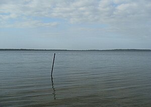
| The Wittensee from the west | ||
| Geographical location | District of Rendsburg-Eckernförde , Schleswig-Holstein | |
| Tributaries | Habyer Au , Mühlenbek | |
| Drain | Schirnau in the direction of the Kiel Canal | |
| Location close to the shore | Rendsburg | |
| Data | ||
| Coordinates | 54 ° 23 '9 " N , 9 ° 45' 33" E | |
|
|
||
| Altitude above sea level | 3.8 m | |
| surface | 9.914 km² | |
| length | 4.92 km | |
| width | 2.58 km | |
| volume | 97.80 million m³ | |
| scope | 14.9 km | |
| Maximum depth | 20.5 m | |
| Middle deep | 9.86 m | |
| PH value | 8.5 | |
| Catchment area | 48.01 km² | |
|
particularities |
The lake is almost rectangular (5 × 2 km) and you can see the position of the glacier tongues as an extension of the Eckernförde Bay. Good sailing area, fishing, surfing, camping |
|
The Wittensee ( Danish : Vittensø ) is a glacial terminal moraine lake in the eastern hilly landscape of Schleswig-Holstein . It is located in the south of the Hüttener Berge nature reserve in the city triangle of Schleswig , Rendsburg and Eckernförde . To the west of the lake is the smaller Bistensee .
location
The communities Groß Wittensee , Klein Wittensee and Bünsdorf are located on the shores of the lake . The lake has several tributaries, of which the Habyer Au , which flows into the lake at the southeast corner, is the largest. The outflow is the Schirnau . It leaves the lake at its southwest corner, leads about 3 km to the south and flows into the Kiel Canal at Gut Schirnau . Before the canal was built, it flowed into the Eider at the same point .
The Wittensee was created during the Vistula Ice Age: The large Baltic Sea glacier in Schleswig-Holstein was divided into a "Holstein Lobus " and a "Eckernförde Lobus"; the “Eckernförde Lobus” in turn divided into a northern (“ Windebyer-Noor tongue”) and a southern one (“Wittensee- Goossee ”) in what is now the Eckernförde area, taking advantage of a contour of the Eckernförde Bay (which according to some geologists was created before the Ice Age) -Tongue ") Partial ice tongue. The northern tongue formed u. a. the Hüttener Berge , the Wittensee-Goossee-Tunge the Duvenstedter Berge.
There are bathing areas monitored in accordance with the Bathing Water Directive in Bünsdorf, Groß Wittensee (Seegarten) and on Habyer Str. The official monitoring of the long-term bathing area in Sande (Klein Wittensee) was lifted in 2016. There has been a replacement since summer 2017 with the bathing area in the “Am See” development area.
See also
Web links
- Environmental report of the state of Schleswig-Holstein
- Tourism at the Wittensee
- Tourism in the Hüttener Berge region
- Wittensee recreation and education center
literature
- Wittensee . In: State Office for Nature and Environment of the State of Schleswig-Holstein (Ed.): Short Lake Program 1998. Bordesholmer See, Gammellunder See, Owschlager See, Schülldorfer See, Winderatter See, Wittensee. Kiel 2001, pp. 88–105 ( PDF file )
Individual evidence
- ↑ a b c d e Wittensee: Characteristic data . In: Ministry for Energy Transition, Agriculture, Environment and Rural Areas Schleswig-Holstein: Lakes (accessed on September 21, 2012)
- ↑ a b c Brigitte Nixdorf, Mike Hemm, Anja Hoffmann, Peggy Richter: Documentation of the condition and development of the most important lakes in Germany: Part 1 Schleswig-Holstein . Final report R&D project FKZ 299 24 274 on behalf of the Federal Environment Agency, 2004 ( PDF file; 2.1 MB )
- ↑ Bathing water quality in Bünsdorf
- ↑ Bathing water quality in Groß Wittensee, Seegarten
- ↑ Bathing water quality in Groß Wittensee, Habyer Str.
- ↑ Communication from the Rendsburg-Eckernförde district
- ↑ New swimming area in Klein Wittensee. Pack your swimming trunks ... - , Eckernförder Zeitung, July 18, 2017.
- ↑ Bathing water quality in Klein Wittensee, Strandweg

