Graft-De Rijp
 flag |
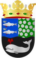
 coat of arms |
| province |
|
| local community |
|
|
Area - land - water |
21.76 km 2 19.93 km 2 1.83 km 2 |
| Residents | 6,406 (Dec 31, 2014) |
| Coordinates | 52 ° 34 ′ N , 4 ° 52 ′ E |
| Important traffic route |
|
| prefix | 0299, 075 |
| Postcodes | 1483-1488, 1436 |
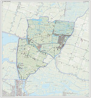
Graft-De Rijp ( ) was a municipality in the Dutch province of North Holland , which last had 6406 inhabitants (as of December 31, 2014) on a total area of 21.76 km². Since January 1st 2015 the former municipality belongs to the municipality Alkmaar .
Location and economy
The twin village lies between the cities of Alkmaar and Purmerend on the edge of the Beemster polder. The most important sources of income are agriculture, horticulture and tourism.
Localities of the former municipality
- De Rijp
- Graft
- Brand within
- Noordeinde
- Oost-Graftdijk
- Star Sea
- West Graftdijk
- Kogerpolder
history
The two villages Graft and De Rijp both emerged in the Middle Ages. In the Golden Age , the 17th century, they were important places where many seafarers, deep-sea fishermen and whalers lived. The nearby inland lakes Beemster (1607–1612), Purmer (1618–1622), Wormer (1624–1626) and Schermer were drained under the direction of De Rijper mill builder Jan Adriaanszoon Leeghwater and converted into polders with fertile meadows. After 1680 the two rival villages became very impoverished.
On January 1, 2015, Graft-De Rijp was incorporated into the municipality of Alkmaar.
politics
Distribution of seats in the municipal council
| Political party | Seats | |
|---|---|---|
| 2006 | 2010 | |
| PvdA | 5 | 5 |
| VVD | 3 | 3 |
| CDA | 4th | 3 |
| Het Verschil | 1 | 2 |
| total | 13 | 13 |
Attractions
The Graft to the west has a town hall from 1613 that is well worth seeing.
To the east of it, De Rijp looks like an open-air museum: around 300 houses with wooden gables from the 17th and 18th centuries in North Holland style still stand on the small canals and streets. The town hall (1630) with Waag and the church in the center are also worth seeing. In the area, a bike or car tour through the polder landscape with the old, monumental farms is worthwhile.
traffic
The national road N 244 from Alkmaar to Purmerend runs through De Rijp from west to east.
The R-Net bus line 305 runs from De Rijp every 30 minutes to Amsterdam Centraal via Purmerend. The connection from Graft and De Rijp to the city of Alkmaar is made with the bus line 123 of the transport company Connexxion . There is also the local bus line 416 (Buurtbus) via Midden beemster to Purmerend.
Personalities
- Johan de Haas (1897–1945), author and anarchist
De Rijp Gallery
Web links
Individual evidence
- ↑ a b Bevolkingsontwikkeling; regio per maand Centraal Bureau voor de Statistiek , accessed on April 17, 2018 (Dutch)
- ↑ Result of the local elections , accessed on April 17, 2018 (Dutch)
- ↑ Allocation of seats in the municipal council , accessed on April 17, 2018 (Dutch)


