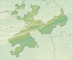
Grenchenberg
| Grenchenberg | ||
|---|---|---|
| height | 1405 m above sea level M. | |
| location | Cantons of Bern and Solothurn , Switzerland | |
| Mountains | law | |
| Dominance | 3.8 km → Stallflue | |
| Notch height | 52 m ↓ Obergrenchenberg | |
| Coordinates | 596 843 / 231225 | |
|
|
||
| Development | Bus route 38 of the BGU | |
As Grenchenberg one will plateau west of White Stone called. It belongs to the Swiss Jura .
The highest point is at 1405 m above sea level. M. lying ridge (mountain ridge), which separates the French-speaking Jura from the German-speaking Mittelland . At the same time, the ridge forms the border between the two cantons of Bern and Solothurn .
An asphalt road leads from Grenchen over the Grenchenberg to Court . On the southern side of the road, buses run by the Grenchen and surrounding area .
The Grenchenberg is crossed by the Grenchenberg Tunnel, a railway tunnel of the Jura Railway .
Wind power plant
Because the plateau is very windy, which rotate here rotors of a wind turbine . This has a nominal output of 150 kW and produces around 100,000 kWh of electricity annually. The Grenchen wind power project is also expected to be completed by 2018 . According to the project description, six wind turbines with a total output of 16 MW will generate 32,000 MWh of electricity annually.
Jurassic observatory
In 1975/76 an observatory was built on the Grenchenberg. Since the location is in the Jura protection zone , the construction project was controversial. Due to the light pollution in the city of Grenchen and the resulting urgency for the location on the mountain, the building permit was granted. The building was financed with donations from the public sector , industry and commerce . The operation of the observatory is guaranteed by a foundation .
Winter sports
There are two ski lifts on the Grenchenberg , which are in regular operation due to the good location (north slope at 1300 m above sea level ). The larger ski lift was built in 1958 and was originally 395 meters long. In 1973 it was extended to 445 meters. The second ski lift is 200 meters long and is ideal for learning to ski and snowboard.
A 20-kilometer cross-country ski run was prepared on the Grenchenberg for 30 years . This trail was closed in 2004 for personal and financial reasons.
Web links
- Grenchen tourist information about the ski lifts
- www.grenchenberge.ch
- Webcams
Individual evidence
- ↑ Grenchenberg wind power plant. Retrieved July 13, 2012 .
- ↑ Grenchen wind power. Retrieved October 26, 2016 .
- ↑ website of Jura Observatory. Retrieved July 13, 2012 .
- ^ History of the Grenchenberg ski lift. (No longer available online.) Archived from the original on January 10, 2012 ; Retrieved July 13, 2012 . Info: The archive link was inserted automatically and has not yet been checked. Please check the original and archive link according to the instructions and then remove this notice.
- ↑ Grenchen tourist office: The end of the Grenchenberg cross-country ski trail. (No longer available online.) August 23, 2003, formerly in the original ; Retrieved July 13, 2012 . ( Page no longer available , search in web archives ) Info: The link was automatically marked as defective. Please check the link according to the instructions and then remove this notice.


