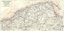
Bożepole Wielkie
Bożepole Wielkie ( German Groß Boschpol , formerly Groß Botzepol ) is a village in the rural municipality of Łęczyce ( Lanz ) in the Polish Pomeranian Voivodeship and belongs to the powiat Wejherowski ( Neustädter District ).
Geographical location and traffic
The village is located in Hinterpommern , about 15 kilometers east-northeast of Lauenburg in Pomerania ( Lębork ). The Leba flows through the village .
The town's train station is on the Gdańsk – Stargard railway line .
history

Around 1784 there were two farms in the parish village of Groß Bozepol or Boschpoll , one of which was called Golecza or Golitz and was located on the Feldmark, a water mill , three farms, three cottages , a restaurant on the road from Lauenburg to Danzig , » Groß-Ankerholz ”and a total of 16 fireplaces (households). The village belonged to the landowner Henrietta Sophia Louisa von der Goltz , nee. v. Krockow , who was married to the Royal Polish Major General Heinrich von der Goltz.
Since 1874, Groß Boschpol was the administrative seat of the administrative district Groß Boschpol, to which the following localities belonged: 1) Manor Paraschin, 2) Manor Groß Boschpol, 3) Rural Municipality of Groß Boschpol, 4) Manor district of Klein Boschpol, 5) Rural municipality of Klein Boschpol and 6) Manor Chmelenz . Head of office at the time was the tenant v. Weiher zu Groß Boschpol (deputy manor owner von Zelowski zu Parashin). Around 1912 the district only comprised five villages, as the rural community of Groß Boschpol had meanwhile lost its independence. The owner of the Groß Boschpol estate was Max von Weiher from 1905 until 1928 .
The district of Groß Boschpol belonged to the district of Lauenburg in Pomerania in the administrative district of Köslin of the Pomerania province of the German Empire in 1945 .
Towards the end of the Second World War , the Red Army occupied the region in the spring of 1945 . Soon afterwards, Western Pomerania, along with West Prussia and the southern half of East Prussia, was placed under Polish administration by the Soviet Union . The immigration of Polish civilians then began in Groß Boschpol. Greater Boschpol received the Polish place name Bożepole Wielkie . In the following time the old inhabitants were expelled .
The place is incorporated into the Gmina Łęczyce in powiat Wejherowski in the Pomeranian Voivodeship (1975-1998 Gdansk Voivodeship ).
Population development
| year | Residents | Remarks |
|---|---|---|
| 1867 | 10 | |
| 1871 | 5 | all of the Protestant denomination |
| 1925 | 455 | including 349 Protestants and 106 Catholics |
| 1933 | 361 | |
| 1939 | 360 |
Personalities associated with the place
- Ernst Carl Ludwig von Weiher (1751–1814), German landowner and district administrator , died here.
literature
- Ludwig Wilhelm Brüggemann Detailed description of the current state of the Königl. Prussian Duchy of Vor and Hinter Pomerania . Part II, Volume 2: Description of the court district of the Royal. State colleges in Cößlin belonging to the Eastern Pomeranian districts . Stettin 1784, p. 1065, paragraph (9) .
- Franz Schultz : History of the Lauenburg district in Pomerania. Lauenburg i. Pom. 1912, pp. 328-332.
- Heinrich Koops: Heimatbuch Lauenburg / Pom. 1967.
Web links
- The community of Groß Boschpol in the former Lauenburg district in Pomerania (Gunthard Stübs and Pommersche Forschungsgemeinschaft, 2011)
- Groß Boschpol district (Rolf Jehke, 2011)
- Groß Boschpol, with Groß Boschpol station and Wiesenkaten (Lauenburg / Pomerania district) (Uwe Kerntopf, 1998 ff.)
- Memorial plaque for the local soldiers who died in the First World War from the church of Groß Boschpol
Footnotes
- ↑ Ludwig Wilhelm Brüggemann Detailed description of the current state of the Königl. Prussian Duchy of Vor and Hinter Pomerania . Part II, Volume 2: Description of the court district of the Royal. State colleges in Cößlin belonging to the Eastern Pomeranian districts . Stettin 1784, p. 1065, paragraph (9) .
- ↑ a b Extra sheet to the Official Gazette of the Royal Government at Coesslin of March 16, 1874, p. 3.
- ^ Franz Schultz : History of the Lauenburg district in Pomerania. Lauenburg i. Pom. 1912, p. 38, no.26.
- ↑ http://www.schlossarchiv.de/haeuser/b/BO/S/Grossboschpol.htm
- ↑ a b Prussian State Statistical Office: The municipalities and manor districts of the Prussian state and their population ( the municipalities and manor districts of the province of Pomerania ). Berlin 1873, pp. 164–165, No. 5.
- ^ The community of Groß Boschpol in the former Lauenburg district in Pomerania (Gunthard Stübs and Pommersche Forschungsgemeinschaft, 2011)
- ^ A b Michael Rademacher: German administrative history from the unification of the empire in 1871 to the reunification in 1990. lauenburg_p.html. (Online material for the dissertation, Osnabrück 2006).
Coordinates: 54 ° 34 ' N , 17 ° 58' E
