Large pond
|
Large pond
municipality Moosthenning
Coordinates: 48 ° 41 ′ 38 ″ N , 12 ° 31 ′ 12 ″ E
|
||
|---|---|---|
| Height : | 434 m above sea level NN | |
| Residents : | 13 (May 25 1987) | |
|
Location of Großweiher in Bavaria |
||
|
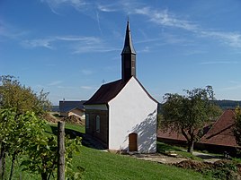
The St. Stephan branch church
|
||
Großweiher is a hamlet and a district in the Thürnthenning district of the Moosthenning municipality in the Dingolfing-Landau district in Lower Bavaria .
location
Großweiher is located in the Danube-Isar hill country about two kilometers northeast of Moosthenning.
history
Großweiher was part of the municipality of Thürnthenning , with which it came to the municipality of Moosthenning on April 1, 1971 as part of the regional reform in Bavaria . Ecclesiastically, Großweiher belongs to the parish of Ottering .
Attractions
- Filial church St. Stephan. The small hall building with roof turret dates from the second half of the 15th century.
literature
- Statistical description of the Catholic pastoral care offices and other spiritual benefices in the administrative districts of Lower Bavaria . Landshut, 1863
- Federal Statistical Office (Hrsg.): Historical municipality register for the Federal Republic of Germany. Name, border and key number changes in municipalities, counties and administrative districts from May 27, 1970 to December 31, 1982 . W. Kohlhammer, Stuttgart / Mainz 1983, ISBN 3-17-003263-1 .
Web links
- Large pond in the location database of the Bavarian State Library Online . Bavarian State Library
Commons : Großweiher St. Stephan (Moosthenning) - Collection of images, videos and audio files
Individual evidence
- ↑ Bavarian State Office for Statistics and Data Processing (Ed.): Official local directory for Bavaria, territorial status: May 25, 1987 . Issue 450 of the articles on Bavaria's statistics. Munich November 1991, DNB 94240937X , p. 174 ( digitized version ).


