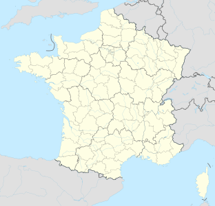
Grotto mandrin
| Grotto mandrin
|
||
|---|---|---|
| Location: | Malataverne , Region Auvergne Rhône-Alpes , Drôme , France | |
| Height : | 245 m | |
|
Geographic location: |
44 ° 28 '10.4 " N , 4 ° 46' 16.9" E | |
|
|
||
| Cadastral number: | RHAAA0004031 | |
| Geology: | limestone | |
| Type: | Karst cave | |
| Discovery: | 1960 | |
| Overall length: | 8 m | |
| Website: | La Grotte Mandrin | |
The Mandrin Grotto is a semi-cave near the small French town of Malataverne near Montélimar in the Drôme department . It is an archaeological site with an exceptionally large number of well-preserved finds from the transition from the Middle to the Upper Palaeolithic . The oldest find layer is 120,000 years old.
It is named after the French folk hero Louis Mandrin .
Geographical location
The Abri , located in the middle of the Rhone Valley , is about 2.5 km southeast of the center of Malataverne at the foot of an exposed limestone cliff at 245 m above sea level . Two hills form an approximately 350 m wide bottleneck through which important traffic routes run with the A7 , N7 , D169 and the high-speed route LGV Méditerranée .
topography
The Mandrin grotto is now 8 m deep. Large boulders on the slope below the demolition come from the partial collapse of the rock overhang, the covered area was originally much larger. The approximately 12 m wide opening faces north. The cave ceiling reaches a height of 2.5 m in the front area and drops from halfway to the rear by around 1 m. In 2013 the area in front of the Abri was roofed over and fenced in, and the area has been under video surveillance since 2016 .
Research history
The Mandrin cave was recognized as archaeologically significant in the 1960s by Gaston Etienne (1923–2010), a Malatavern city council who came across traces of settlement there from the Bronze Age . Excavation campaigns have been held annually since 1991, and since 2006 under the direction of Ludovic Slimak - a research fellow at the University of Toulouse and the CNRS . So far (as of 2014) seven of the twelve culture layers have been excavated, the sequence of layers (A to F) dates from 42,000 cal BP (early Protoaurignacia) to 56,000 cal BP (La Quina-Moustérien) .
See also
literature
- Laure Metz, Ludovic Slimak: La Grotte Mandrin . Derniers Néandertaliens et premiers Hommes modern en vallée du Rhône. In: Archéologia . No. 555 , 2017, p. 20-27 (French).
- Ludovic Slimak, Colette Paillole, Erwin Tscherter: Autour de la Grotte Mandrin à Malataverne (Drôme) . Entretien avec Ludovic Slimak. In: Ardèche archeology . No. 32 , 2015, p. 3–10 (French).
Web links
Individual evidence
- ↑ La Grotte Mandrin - Homo Sapiens, arrivé trop tôt ... ( Memento of the original from October 7, 2016 in the Internet Archive ) Info: The archive link was inserted automatically and has not yet been checked. Please check the original and archive link according to the instructions and then remove this notice. (French), accessed October 7, 2016
- ↑ a b Internet presence of the municipality of Malataverne - La Grotte Mandrin ( Memento of the original from October 6, 2016 in the Internet Archive ) Info: The archive link has been inserted automatically and has not yet been checked. Please check the original and archive link according to the instructions and then remove this notice. (French), accessed October 6, 2016
- ^ Ludovic Slimak, Colette Paillole, Erwin Tscherter: Autour de la Grotte Mandrin à Malataverne (Drôme) Entretien avec Ludovic Slimak . Ardèche Archéologie, Viviers 2015. n ° 32, pp. 3–10 (French)
- ↑ PLOS One - Convergent Evidence of Eagle Talons Used by Late Neanderthals in Europe: A Further Assessment on Symbolism , accessed on October 6, 2016

