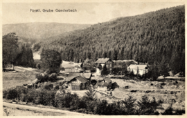
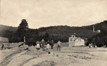
Gonderbach pit
| Gonderbach (Friedrich Hope) | |||
|---|---|---|---|
| General information about the mine | |||
| The pit around 1910 | |||
| Information about the mining company | |||
| Employees | 78 (1868) | ||
| Start of operation | 1350 | ||
| End of operation | 1939 | ||
| Funded raw materials | |||
| Degradation of | Lead ore , copper ore , silver ore | ||
| Greatest depth | 100 m | ||
| Geographical location | |||
| Coordinates | 50 ° 52 '37 " N , 8 ° 19' 14" E | ||
|
|||
| Location | Fischelbach | ||
| local community | Bad Laasphe | ||
| District ( NUTS3 ) | Siegen-Wittgenstein | ||
| country | State of North Rhine-Westphalia | ||
| Country | Germany | ||
The Gonderbach mine (formerly Friedrichshoffnung) was an ore mine near Fischelbach , a district of Bad Laasphe in the Siegen-Wittgenstein district . The pit was in the valley of the Gonderbach between Fischelbach and Sohl . Mainly red gold ore ( Proustit and Pyrargyrite ) with approx. 60% silver and lead ore with solid silver were mined.
history
It is not known when mining began in the Gonderbachtal . In 1365 the first income was booked. At the end of the 14th century, expenses outweighed income. 1599 costs are mentioned before unslit 21 albus . The mention of unslit (candles) is a first indication of underground mining . In 1619 the name Friedrichshoffnung was first recorded. Towards the end of the 17th century, Gonderbach began to flourish.
The princes of Sayn-Wittgenstein owned the mine . After a break in operations and a few tunnels , mining was resumed in 1850, civil engineering began in 1854 , ten years later the 100 m deep Alexander shaft was sunk and equipped with a steam engine. In the same year a profit of 27,000 Reichstaler was achieved through the sale of silver ore . While 38 people found work in the mine in 1862, six years later there were already 78. The workforce in 1862 was divided into a Steiger , 22 miners and 15 processing workers . In 1862 70 t of lead ore and 223 kg of red gold ore were mined, in 1863 production increased to 190 t, dropped to 149 t in 1866 and rose again to 193 t of lead ore a year later. But as early as 1871, the mechanical operation had to be stopped due to a lack of coal . The production up to the termination amounted to 1958 t lead ore, 29 t red gold ore and 1.6 t silver ore valued at 450,000 marks. Between 1873 and 1877 found investigative work rather than on the pit and the degradation was all set.
In 1891 the funding was:
- 2,011 t lead gloss
- 56.6 t of Pale ore containing copper or lead
- 42.5 t of red or gray ore
- 34 t of glaze ore
- 785 kg of copper ore
- 42 kg of solid silver
- 406 valuable Red Valid lead ore crystals
In 1906 the wooden water wheel was replaced by a new iron one. A year later, the buildings around the shaft were demolished, the dismantling now concentrated more on the tunnel level . In 1909 the deep gallery was expanded for a mine railway . From the same year the Alexanderhoffnung , Morgenstern and Berghäuschen mines in Hesselbach were also managed. Between 1907 and 1925, 2,319 t of lead ore were mined. 1931 was the promotion set 1936, which sought Otavi Mining and Railway Company to the operation of the mine. In 1938, 45 miners were already working on Gonderbach, but only one year later the mine was completely closed as the last ore mine in Wittgensteiner Land .
Todays use
The Ludwigstollen has been used for drinking water by the Siegen-Wittgenstein water association since 2016 . The tunnel supplies the places Fischelbach, Hesselbach and Breidenbach with drinking water.
Tunnels and shafts
stollen
- Paris tunnel : hewn in the 18th century, length: 130 m
- Deep tunnel : excavated in 1820, length: over 500 m
- Amalia tunnel : excavated around 1830, length: 200 m
- Ludwigstollen : attached in 1909, used until 1918, length: 2335 m
- Benjamin tunnel : length: approx. 100 m
- "Alter Mann" tunnel : abandoned before 1850, length unknown
- Old tunnel : length unknown
- Gallery 13 : Length: approx. 100 m
- Gallery of the Alexandershoffung mine (in the Gonderbach field) : approx. 250 m
- Erbstollen (in the valley floor) : approx. 50 m
Shafts
- Old shaft : depth approx. 15 m
- Old art shaft : depth: 36 m
- Alexanderschacht (machine shaft): depth: 80 m
- Burbachtal weather shaft : depth: 70 m
- Benjamin shaft: depth unknown
literature
- T. Radenbach (among others): Historical mining in Wittgenstein , Erndtebrück 2008
- Wolfgang Kraus: The ore mining in the county of Wittgenstein . In: Wittgenstein. Leaves of the Wittgensteiner Heimatverein eV Vol. 72 (1984) = Vol. 48, H. 1, pp. 1-44.
- Journal for mining, metallurgy and saltworks, issues 1855–68
- Obersteiger Dietrich: Description of the Fürstlich-Wittgensteinschen lead and silver mine Gonderbach , Bergamt Siegen, 1926
- Fritz Pasdzierny: The Gonderbach mine , 1938
- Horst Koch: The Cut , 1969
Web links
- Gerd Bäumer: Ore mining in the Siegerland area ( Memento from November 7, 2001 in the Internet Archive )
- Ore mining in Wittgenstein - Gonderbach mine
Individual evidence
- ↑ “Glück auf!” Becomes “ Wasser marsch !” DerWesten.de, October 16, 2016, accessed on November 30, 2016 .


