Guadalupe (Peru)
| Guadalupe | |||
|---|---|---|---|
|
|
|||
| Coordinates | 7 ° 15 ′ S , 79 ° 28 ′ W | ||
| Symbols | |||
|
|||
| Basic data | |||
| Country | Peru | ||
| La Libertad | |||
| province | Pacasmayo | ||
| ISO 3166-2 | PE-LAL | ||
| District | Guadalupe | ||
| height | 92 m | ||
| Residents | 21,857 (2017) | ||
| founding | April 15, 1550 | ||
| Website | www.muniguadalupe.gob.pe/web/ (Spanish) | ||
| politics | |||
| mayor | Benjamin Javier Banda Abanto (2019-2022) |
||
|
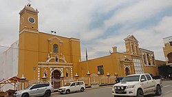
Plaza de Armas in Guadalupe
|
|||
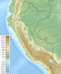
Guadalupe is a city in the La Libertad region of northwest Peru . It is located in the province of Pacasmayo and is the administrative seat of the district of the same name .
The city had a population of 21,857 at the 2017 census. 10 years earlier this was 20,605. Guadalupe is 107 km north-northwest of the regional capital Trujillo . The city is located at an altitude of 92 m 14.5 km from the Pacific coast in the coastal plain of northwest Peru. Irrigated agriculture is practiced in the area. The city of Chepén is 5 km east-northeast of Guadalupe .
Individual evidence
- ↑ a b PERU: Region La Libertad: Provinces & Places . www.citypopulation.de. Retrieved January 23, 2020.
Web links
Commons : Guadalupe - collection of images, videos and audio files


