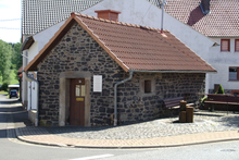
Gunzenau
|
Gunzenau
Municipality Freiensteinau
Coordinates: 50 ° 27 ′ 42 ″ N , 9 ° 24 ′ 18 ″ E
|
|
|---|---|
| Height : | 496 m above sea level NHN |
| Area : | 5.68 km² [LAGIS] |
| Residents : | 144 (Jun. 30, 2017) |
| Population density : | 25 inhabitants / km² |
| Incorporation : | December 31, 1971 |
| Postal code : | 36399 |
| Area code : | 0 66 44 |
Gunzenau is a district of the municipality of Freiensteinau in the Vogelsbergkreis in central Hesse .
geography
location
Gunzenau is located in the southeastern Vogelsberg, northwest of the Naxburg and southeast of the Horst .
Neighboring places
Gunzenau borders in the north on the place Metzlos , in the northeast on the place Jossa , in the east on the place Reichlos , in the south on the place Freiensteinau , in the west on the place Ober-Moos and in the north-west on the place Nieder-Moos .
history
The oldest surviving mention of Gunzenau comes from a document from 1012 in which it is called Guncenaho .
In Gunzenau the Riedesel'schen ordinances were considered as particular law . The Common Law applied only to the extent those regulations did not contain provisions. Theoretically, this special right retained its validity even while it belonged to the Grand Duchy of Hesse in the 19th century, but only individual provisions were used in judicial practice. The particular law was replaced on January 1, 1900 by the civil code that was uniformly valid throughout the German Empire .
On December 31, 1971, the place was incorporated into the municipality of Freiensteinau as part of the regional reform in Hesse .
politics
The mayor is Herbert Möller.
literature
- Literature about Gunzenau in the Hessian Bibliography
- Search for Gunzenau in the archive portal-D of the German Digital Library
Web links
- Gunzenau district on the website of the municipality of Freiensteinau.
- gunzenau.de Internet presence of the place.
- Gunzenau, Vogelsberg district. Historical local dictionary for Hessen. (As of July 22, 2015). In: Landesgeschichtliches Informationssystem Hessen (LAGIS).
Individual evidence
- ↑ Facts & Figures - Population figures on the website of the municipality of Freiensteinau
- ^ Arthur Benno Schmidt The historical foundations of civil law in the Grand Duchy of Hesse . Curt von Münchow, Giessen 1893, p. 29, note 92 and p. 103, note 14.
- ^ Federal Statistical Office (ed.): Historical municipality directory for the Federal Republic of Germany. Name, border and key number changes in municipalities, counties and administrative districts from May 27, 1970 to December 31, 1982 . W. Kohlhammer GmbH, Stuttgart / Mainz 1983, ISBN 3-17-003263-1 , p. 367 .


