Gwalior (Division)
| Gwalior Division | ||
|---|---|---|
|
|
||
| State : | Madhya Pradesh | |
| Coordinates | 26 ° 14 ' N , 78 ° 10' E | |
| Administrative headquarters : | Gwalior | |
| Area : | 29,608 km² | |
| Residents : | 5,363,881 | |
| Population density : | 181 inhabitants / km² | |
| Districts : | 5 | |
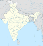
Gwalior is a division in the Indian state of Madhya Pradesh . The capital is Gwalior .
Districts
The Gwalior division consists of five districts :
| District | Capital | Area in km² | Population (as of 2001) | Population density in E / km² |
|---|---|---|---|---|
| Ashoknagar | Ashoknagar | 4,674 | 688.920 | 147 |
| Datia | Datia | 2,694 | 627.818 | 233 |
| Guna | Guna | 6,485 | 976.596 | 151 |
| Gwalior | Gwalior | 5,465 | 1,629,881 | 298 |
| Shivpuri | Shivpuri | 10,290 | 1,440,666 | 140 |
