Indore (division)
| Indore Division | ||
|---|---|---|
|
|
||
| State : | Madhya Pradesh | |
| Coordinates | 22 ° 42 ' N , 75 ° 54' E | |
| Administrative headquarters : | Indore | |
| Area : | 45,209.24 km² | |
| Residents : | 12,718,222 | |
| Population density : | 281 inhabitants / km² | |
| Districts : | 7th | |
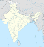
Indore is a division in the Indian state of Madhya Pradesh . The capital is Indore .
Districts
The division consists of seven districts :
| District (other name) | Capital | Area in km² | Population (as of 2001) | Population density in E / km² |
|---|---|---|---|---|
| Alirajpur | Alirajpur | 2,165.24 | 2,488,003 | 1,149 |
| Barwani | Barwani | 5,432 | 1,081,039 | 199 |
| Burhanpur | Burhanpur | 4,573 | 634.883 | 139 |
| Dhar | Dhar | 8,153 | 1,740,577 | 213 |
| Indore | Indore | 3,898 | 2,585,321 | 663 |
| Jhabua | Jhabua | 6,782 | 1,396,677 | 206 |
| Khandwa (East Nimar) | Khandwa | 6.206 | 1,261,768 | 203 |
| Khargone (West Nimar) | Khargons | 8,010 | 1,529,954 | 191 |
Individual evidence
- ↑ a b Madhya Pradesh State website , Retrieved March 2, 2010.
